|
|
| 11821 SIX FORKS RD |
|
| RALEIGH , NC 27614-8150 |
|
| Property
Location Address |
|
| Parcel
ID No. |
3721124926.000 |
| PIN |
3721 12 4926 000 |
| Previous Parcel |
3721124843.000 |
| Owner ID |
1119291 |
| |
|
| Tax
District |
31 - C/CIWI-WILSON |
| |
| Land Use Code |
40 |
| Land Use Desc |
INDUSTRIAL |
| |
|
| Neighborhood |
8383 - WILSON_SOUTH_I-2 |
|
| Legal
Desc |
6799 WARD BLVD |
| |
L1 6.46AC |
| |
|
| Deed
Year Bk/Pg |
2020 - 2830 / 739 |
| Plat
Bk/Pg |
36 / 101 |
| |
Sales
Information |
| |
| Grantor |
LEE SANDY G |
| |
|
| Sold
Date |
2020-04-20 |
| Sold
Amount $ |
0 |
|
| |
| Market Value $ |
317,426
|
| |
|
Market
Value - Land and all permanent improvements,
if any, effective January 1, 2024, date
of County’s most recent General Reappraisal
|
|
| |
|
| Assessed Value $ |
317,426
|
| |
If
Assessed Value not equal Market Value then
subject parcel designated as a special
class -agricultural, horticultural, or
forestland and thereby eligible for taxation
on basis of Present-Use.
|
|
|
| Year
Built |
1964 |
| Built
Use/Style |
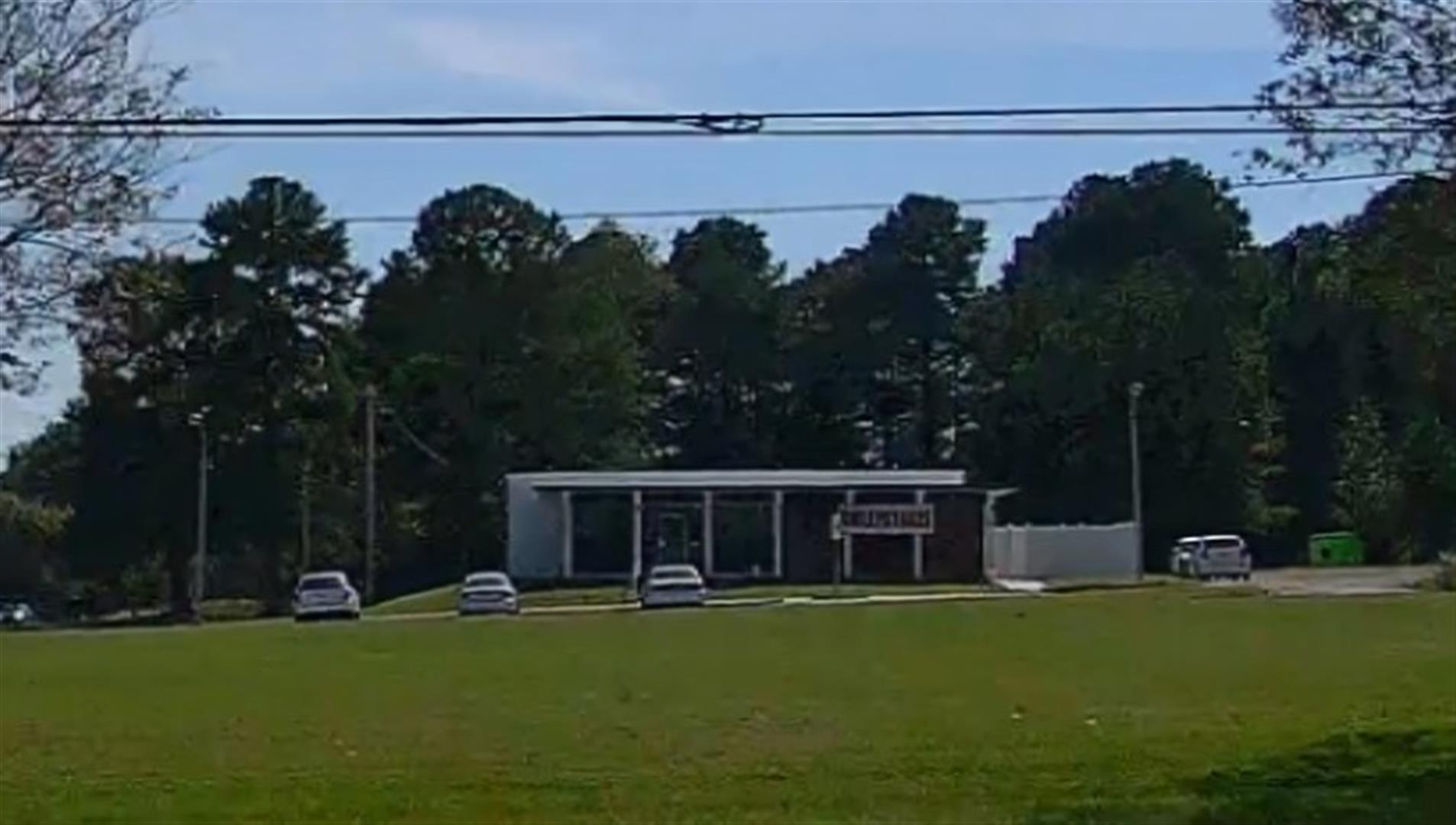
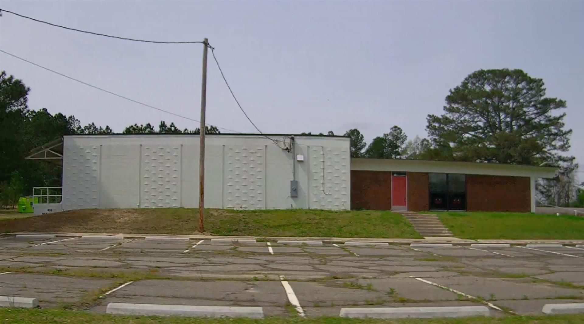
OFFICE/WAREHOUSE |
| Grade |
C / |
| * Percent
Complete |
100 |
| Heated
Area (S/F) |
2,352 |
| Fireplace
(Y/N) |
N |
| Basement
(Y/N) |
N |
| ** Bedroom(s) |
0 |
| ** Bathroom(s) |
0 Full Bath(s) 0 Half Bath(s) |
| *** Multiple
Improvements |
001 |
*
Note - As of January 1
*
* Note - Bathroom(s), Bedroom(s), shown for description
only
* * * Note - If multiple improvements equal “MLT” then
parcel includes additional major improvements |
|
| Building
Sketch - NOTE: Sketches are updated the first day of every month. |
|
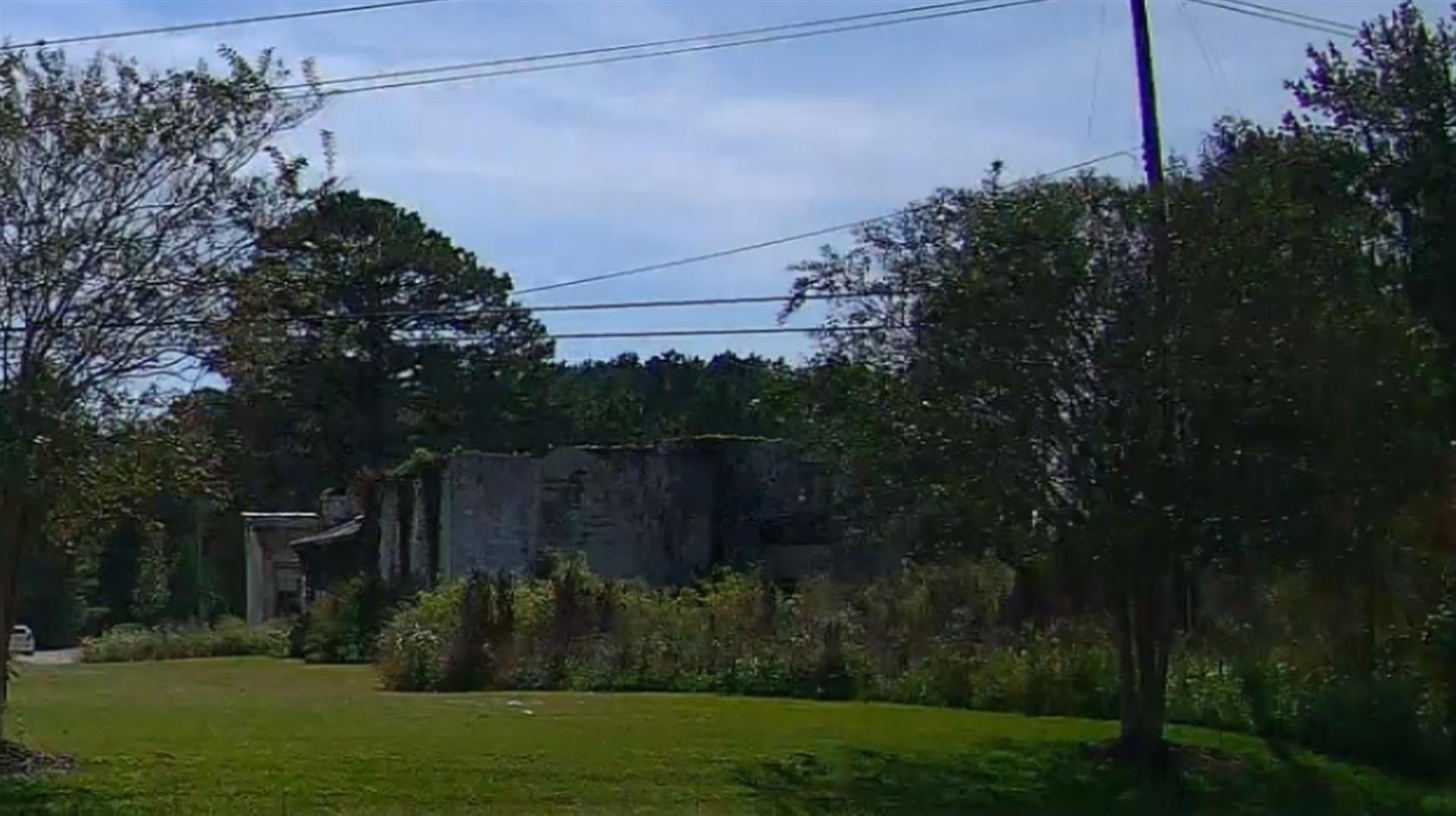
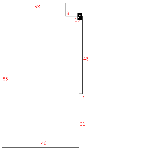
(Building 1) - Sketch for Parcel ID: 3721124926.000
NOTE: Sketches are updated the first day of every month.
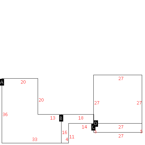 |
| Label |
Description |
Base SF |
Total SF |
| A |
WHSE |
928.00 |
928.00 |
| B |
LOADING PLATFORM |
134.00 |
.00 |
| C |
CANOPY-ECONOMY |
135.00 |
.00 |
| D |
UTILITY STG-FR |
729.00 |
.00 |
|
|
(Building 2) - Sketch for Parcel ID: 3721124926.000
NOTE: Sketches are updated the first day of every month.
 |
| Label |
Description |
Base SF |
Total SF |
| A |
WHSE |
3984.00 |
3984.00 |
|
|
(Building 3) - Sketch for Parcel ID: 3721124926.000
NOTE: Sketches are updated the first day of every month.
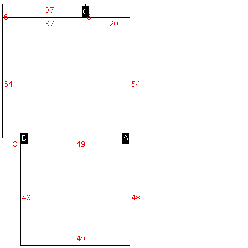 |
| Label |
Description |
Base SF |
Total SF |
| A |
WHSE-OFFICE |
2352.00 |
2352.00 |
| B |
UTILITY STG-FR |
3078.00 |
.00 |
| C |
LOADING PLATFORM |
222.00 |
.00 |
|
|
|
|
|
| Map Acres |
6.46 |
| Tax District Note |
31 - C/CIWI-WILSON |
| Present-Use Info |
INDUSTRIAL |
| Zoning Code |
HI |
| Zoning Desc |
HEAVY INDUSTRIAL |
|
| Total Improvements Valuation
|
*Total Improvements Full Market Value $
|
**Total Improvements Assessed Value
|
36,029
|
36,029
|
*
Note - Market Value effective Date equal January 1, 2024, date of County’s most recent General
Reappraisal
** Note - If Assessed Value not equal Market Value then variance
resulting from formal appeal procedure |
|
| Land
Value Detail (Effective Date January 1, 2024, date
of County’s most recent General Reappraisal) |
Land
Full Value (LFV) $
|
Land
Present-Use Value (PUV) $ **
|
Land
Total Assessed Value $
|
281,397
|
281,397
|
281,397
|
| **
Note: If PUV equal LMV then parcel has
not qualified for present use program |
|
| Land
Detail (Effective Date January 1, 2024, date of County’s
most recent General Reappraisal) |
Rate Type |
Rate Code |
Description |
Quantity |
SF |
0600 |
INDUSTRIAL |
281397.600 |
|
|
|
.000 |
|
|
|
|