|
|
| 3265 MERIDIAN PKWY STE 130 |
|
| WESTON , FL 33331 |
|
| Property
Location Address |
|
| Parcel
ID No. |
3711587971.000 |
| PIN |
3711 58 7971 000 |
| Owner ID |
1104833 |
| |
|
| Tax
District |
31 - C/CIWI-WILSON |
| |
| Land Use Code |
16 |
| Land Use Desc |
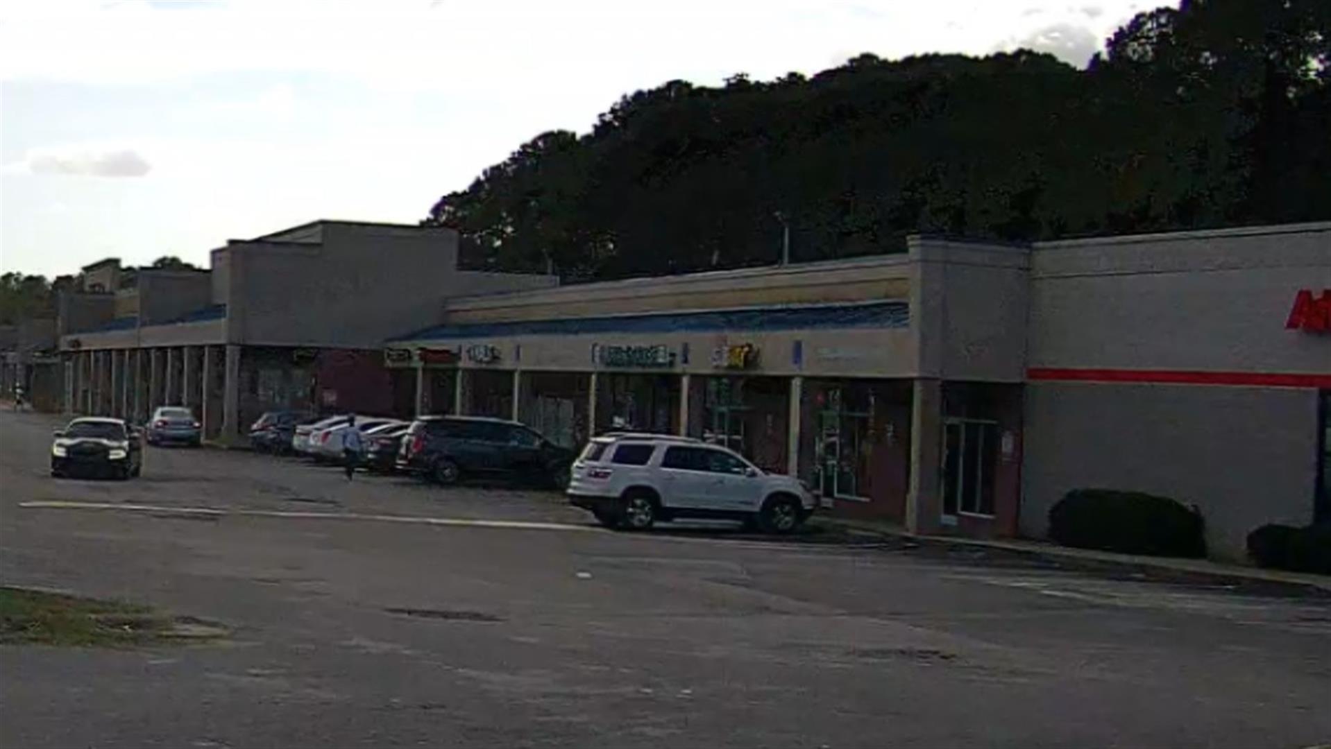
SHOPPING CENTER-STRIP |
| |
|
| Neighborhood |
8355 - WARD-TARBORO_B-3 |
|
| Legal
Desc |
1301 WARD BLVD |
| |
10.62AC |
| |
|
| Deed
Year Bk/Pg |
2015 - 2617 / 964 |
| Plat
Bk/Pg |
/ |
| |
Sales
Information |
| |
| Grantor |
BOULEVARD INVESTORS LLC |
| |
ALBEE REALTY LLC |
| Sold
Date |
2015-06-19 |
| Sold
Amount $ |
0 |
|
| |
| Market Value $ |
4,480,584
|
| |
|
Market
Value - Land and all permanent improvements,
if any, effective January 1, 2024, date
of County’s most recent General Reappraisal
|
|
| |
|
| Assessed Value $ |
4,480,584
|
| |
If
Assessed Value not equal Market Value then
subject parcel designated as a special
class -agricultural, horticultural, or
forestland and thereby eligible for taxation
on basis of Present-Use.
|
|
|
| Year
Built |
1965 |
| Built
Use/Style |
SHOPPING CENTER- STRIP |
| Grade |
C-10 / |
| * Percent
Complete |
100 |
| Heated
Area (S/F) |
42,840 |
| Fireplace
(Y/N) |
N |
| Basement
(Y/N) |
N |
| ** Bedroom(s) |
0 |
| ** Bathroom(s) |
0 Full Bath(s) 0 Half Bath(s) |
| *** Multiple
Improvements |
005 |
*
Note - As of January 1
*
* Note - Bathroom(s), Bedroom(s), shown for description
only
* * * Note - If multiple improvements equal “MLT” then
parcel includes additional major improvements |
|
| Photo |
Photo 1
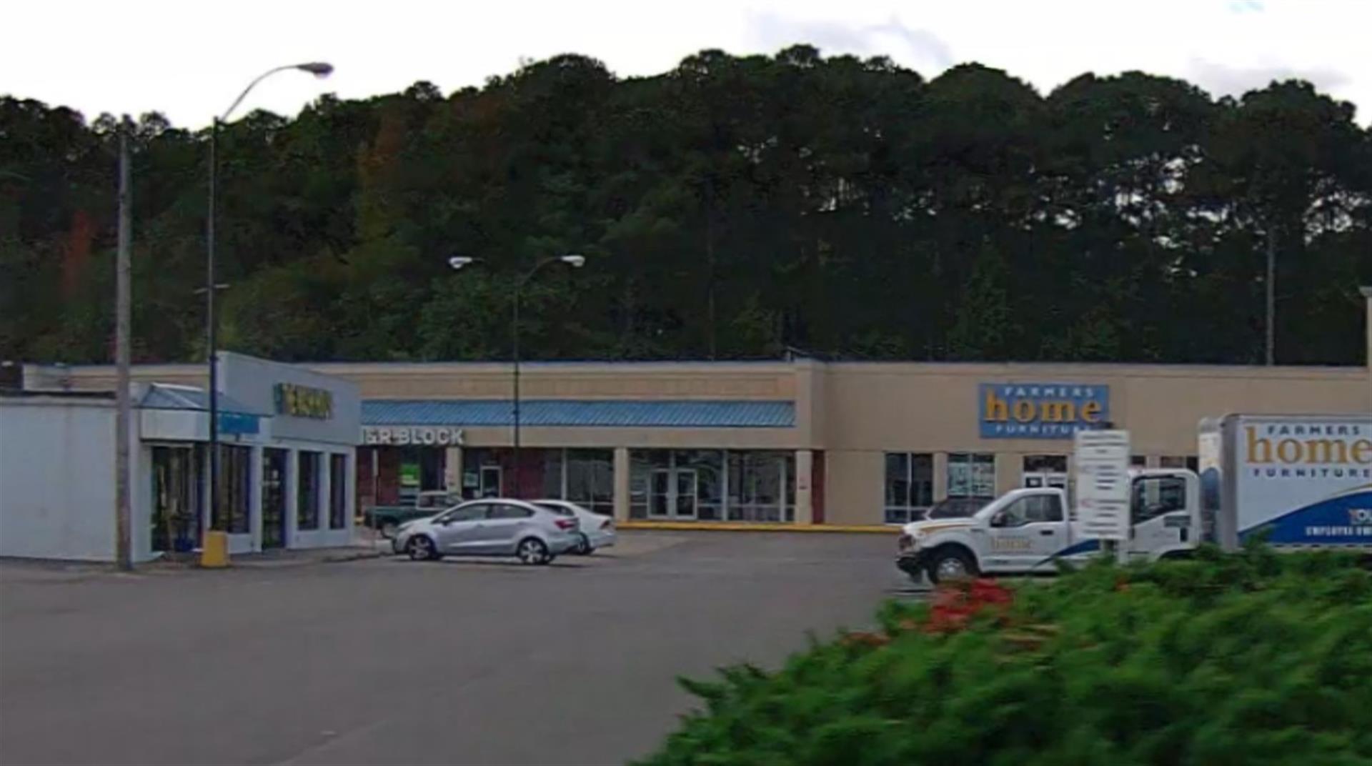 Photo 1
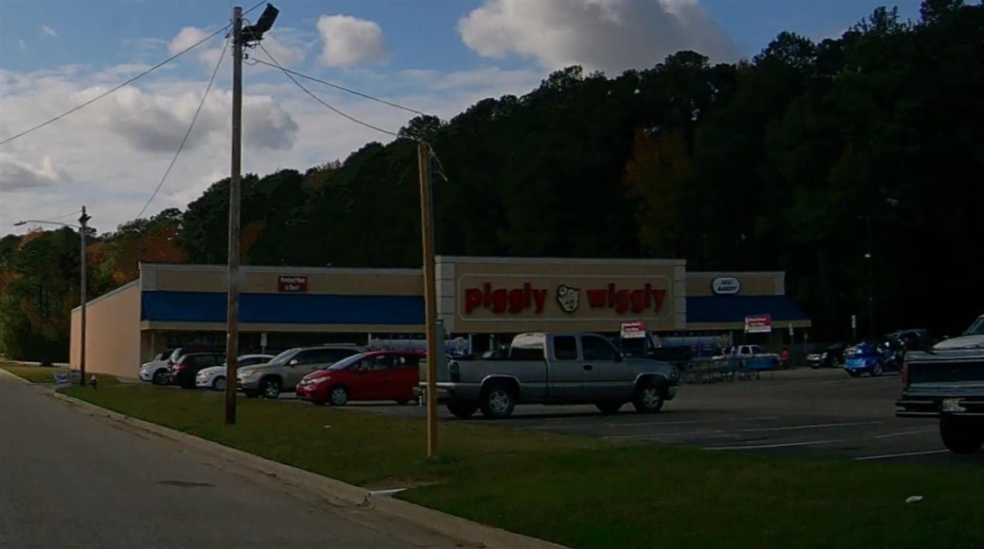 Photo 1
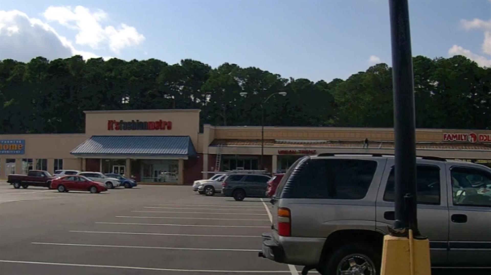 Photo 1
 Photo 1
|
|
| Building
Sketch - NOTE: Sketches are updated the first day of every month. |
|
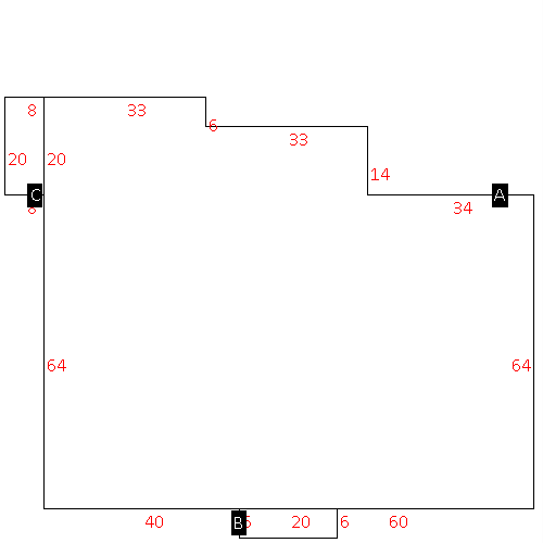
(Building 1) - Sketch for Parcel ID: 3711587971.000
NOTE: Sketches are updated the first day of every month.
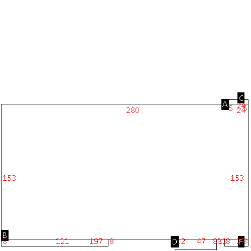 |
| Label |
Description |
Base SF |
Total SF |
| A |
SHOPPING CENTER-STRIP |
42840.00 |
42840.00 |
| B |
CANOPY-ECONOMY |
968.00 |
.00 |
| C |
LOADING PLATFORM |
120.00 |
.00 |
| D |
CANOPY-ECONOMY |
564.00 |
.00 |
| F |
CANOPY-ECONOMY |
216.00 |
.00 |
|
|
(Building 2) - Sketch for Parcel ID: 3711587971.000
NOTE: Sketches are updated the first day of every month.
 |
| Label |
Description |
Base SF |
Total SF |
| A |
SUPERMARKET |
26223.00 |
26223.00 |
| B |
CANOPY-ECONOMY |
400.00 |
.00 |
| C |
UTILITY STG-FR |
648.00 |
.00 |
| D |
UTILITY STG-FR |
1500.00 |
.00 |
| E |
CANOPY-ECONOMY |
247.00 |
.00 |
| F |
CANOPY-ECONOMY |
495.00 |
.00 |
| G |
CANOPY-ECONOMY |
238.00 |
.00 |
| H |
CANOPY-ECONOMY |
253.00 |
.00 |
|
|
(Building 3) - Sketch for Parcel ID: 3711587971.000
NOTE: Sketches are updated the first day of every month.
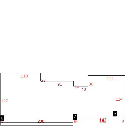 |
| Label |
Description |
Base SF |
Total SF |
| A |
SHOPPING CENTER-STRIP |
40302.00 |
40302.00 |
| B |
CANOPY-ECONOMY |
1600.00 |
.00 |
| C |
CANOPY-ECONOMY |
1136.00 |
.00 |
|
|
(Building 4) - Sketch for Parcel ID: 3711587971.000
NOTE: Sketches are updated the first day of every month.
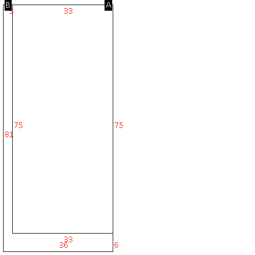 |
| Label |
Description |
Base SF |
Total SF |
| A |
COMMERCIAL-MISC |
2475.00 |
2475.00 |
| B |
CANOPY-ECONOMY |
441.00 |
.00 |
|
|
(Building 5) - Sketch for Parcel ID: 3711587971.000
NOTE: Sketches are updated the first day of every month.
 |
| Label |
Description |
Base SF |
Total SF |
| A |
COMMERCIAL-MISC |
7522.00 |
7522.00 |
| B |
PORCH-OPEN-FR |
120.00 |
.00 |
| C |
CANOPY-ECONOMY |
160.00 |
.00 |
|
|
|
|
|
| Map Acres |
10.62 |
| Tax District Note |
31 - C/CIWI-WILSON |
| Present-Use Info |
SHOPPING CENTER-STRIP |
| Zoning Code |
HC |
| Zoning Desc |
HIGHWAY COMMERCIAL |
|
| Total Improvements Valuation
|
*Total Improvements Full Market Value $
|
**Total Improvements Assessed Value
|
3,127,459
|
3,127,459
|
*
Note - Market Value effective Date equal January 1, 2024, date of County’s most recent General
Reappraisal
** Note - If Assessed Value not equal Market Value then variance
resulting from formal appeal procedure |
|
| Land
Value Detail (Effective Date January 1, 2024, date
of County’s most recent General Reappraisal) |
Land
Full Value (LFV) $
|
Land
Present-Use Value (PUV) $ **
|
Land
Total Assessed Value $
|
1,353,125
|
1,353,125
|
1,353,125
|
| **
Note: If PUV equal LMV then parcel has
not qualified for present use program |
|
| Land
Detail (Effective Date January 1, 2024, date of County’s
most recent General Reappraisal) |
Rate Type |
Rate Code |
Description |
Quantity |
SF |
0716 |
SHOPPING CENTER-STRIP |
462607.000 |
|
|
|
.000 |
|
|
|
|
