| D W WILSON WAREHOUSING IV LLC |
| |
|
| PO BOX 7233 |
|
| ROCKY MOUNT , NC 27804-0233 |
|
| Property
Location Address |
|
| Parcel
ID No. |
3721600786.000 |
| PIN |
3721 60 0786 000 |
| Owner ID |
1107630 |
| |
|
| Tax
District |
31 - C/CIWI-WILSON |
| |
| Land Use Code |
41 |
| Land Use Desc |
LIGHT MANUFACTURING |
| |
|
| Neighborhood |
8383 - WILSON_SOUTH_I-2 |
|
| Legal
Desc |
1920 FARRIOR AVE SE |
| |
L1 TOBACCO PROC 26.27AC |
| |
|
| Deed
Year Bk/Pg |
2016 - 2673 / 118 |
| Plat
Bk/Pg |
33 / 159 |
| |
Sales
Information |
| |
| Grantor |
D W WILSON WAREHOUSING LLC |
| |
|
| Sold
Date |
2016-10-11 |
| Sold
Amount $ |
0 |
|
| |
| Market Value $ |
4,078,464
|
| |
|
Market
Value - Land and all permanent improvements,
if any, effective January 1, 2024, date
of County’s most recent General Reappraisal
|
|
| |
|
| Assessed Value $ |
4,078,464
|
| |
If
Assessed Value not equal Market Value then
subject parcel designated as a special
class -agricultural, horticultural, or
forestland and thereby eligible for taxation
on basis of Present-Use.
|
|
|
| Year
Built |
1981 |
| Built
Use/Style |
MANUFACTURING- LIGHT |
| Grade |
C / |
| * Percent
Complete |
100 |
| Heated
Area (S/F) |
102,678 |
| Fireplace
(Y/N) |
N |
| Basement
(Y/N) |
N |
| ** Bedroom(s) |
0 |
| ** Bathroom(s) |
0 Full Bath(s) 0 Half Bath(s) |
| *** Multiple
Improvements |
004 |
*
Note - As of January 1
*
* Note - Bathroom(s), Bedroom(s), shown for description
only
* * * Note - If multiple improvements equal “MLT” then
parcel includes additional major improvements |
|
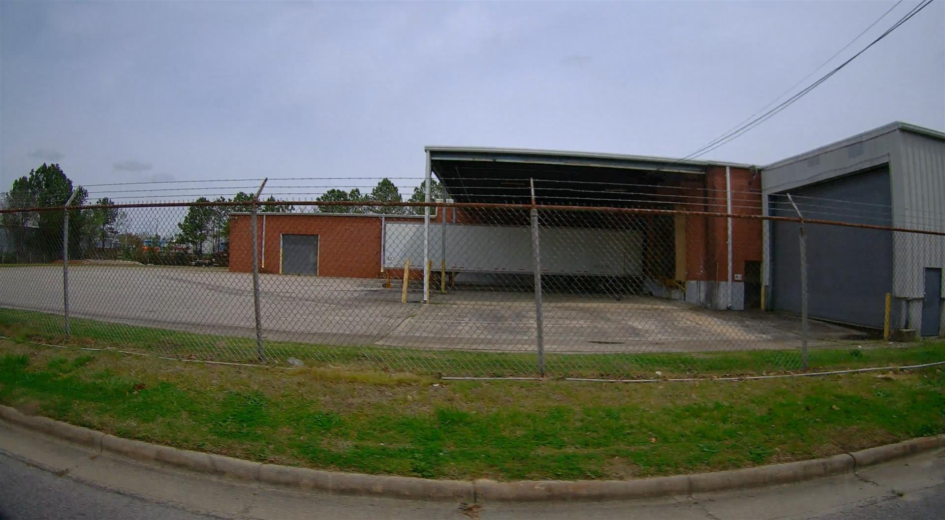
| Photo |
Photo 1
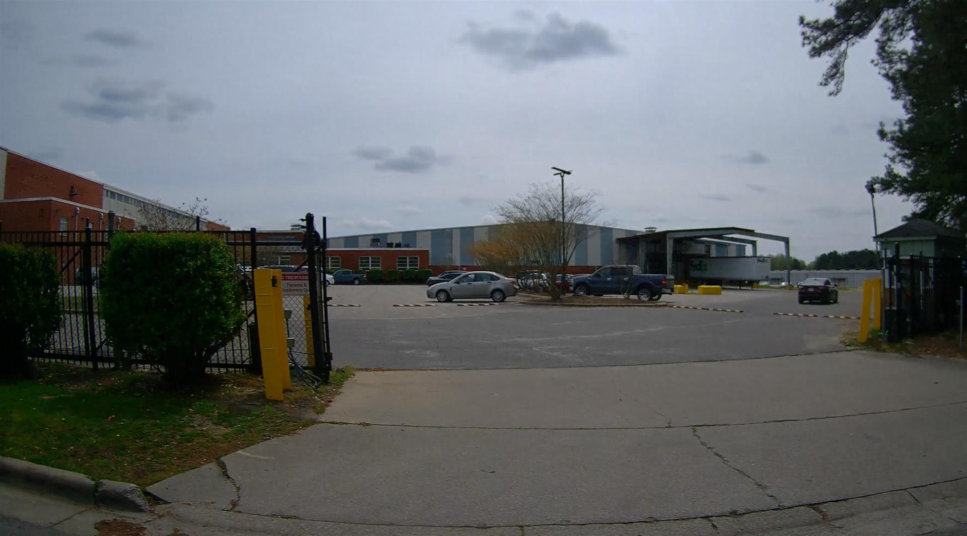 Photo 2
 Photo 3
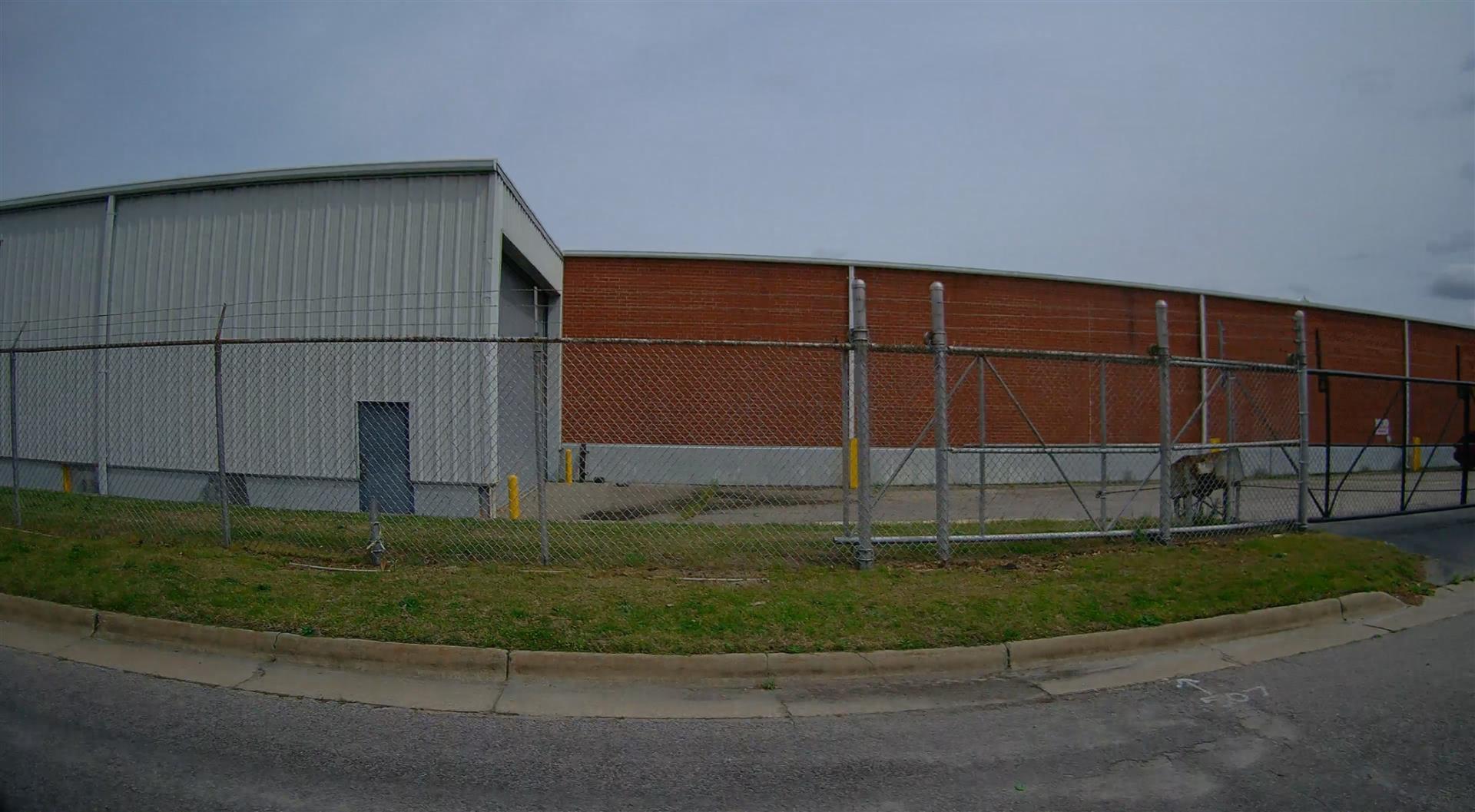 Photo 4
|
|
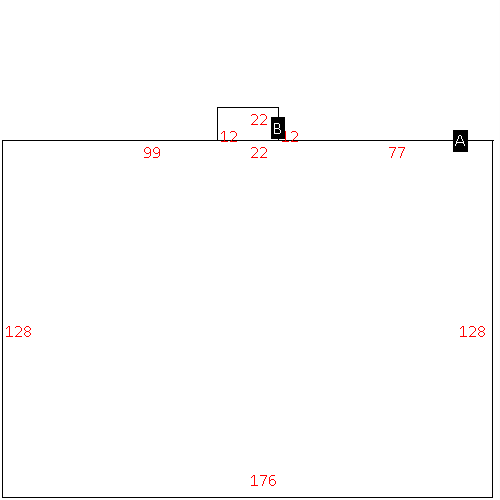
| Building
Sketch - NOTE: Sketches are updated the first day of every month. |
|
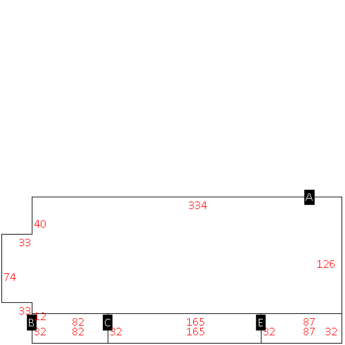
(Building 1) - Sketch for Parcel ID: 3721600786.000
NOTE: Sketches are updated the first day of every month.
 |
| Label |
Description |
Base SF |
Total SF |
| A |
WHSE |
187824.00 |
187824.00 |
| B |
OFFICE BUILDING |
400.00 |
624.00 |
| C |
OFFICE BUILDING |
2750.00 |
2750.00 |
| D |
CANOPY-ECONOMY |
2500.00 |
.00 |
| F |
OFFICE BUILDING |
3296.00 |
3296.00 |
| G |
OFFICE BUILDING |
1122.00 |
1122.00 |
|
|
(Building 2) - Sketch for Parcel ID: 3721600786.000
NOTE: Sketches are updated the first day of every month.
 |
| Label |
Description |
Base SF |
Total SF |
| A |
WHSE |
99442.00 |
99442.00 |
| B |
LOAD PLATFORM,CAN-GOOD |
1320.00 |
.00 |
|
|
(Building 3) - Sketch for Parcel ID: 3721600786.000
NOTE: Sketches are updated the first day of every month.
 |
| Label |
Description |
Base SF |
Total SF |
| A |
WHSE |
102678.00 |
102678.00 |
| B |
PORCH-OPEN-FR |
3660.00 |
.00 |
| C |
CANOPY-AVERAGE |
875.00 |
.00 |
| D |
CANOPY-AVERAGE |
2706.00 |
.00 |
| E |
CANOPY-AVERAGE |
2425.00 |
.00 |
|
|
(Building 4) - Sketch for Parcel ID: 3721600786.000
NOTE: Sketches are updated the first day of every month.
 |
| Label |
Description |
Base SF |
Total SF |
| A |
WHSE |
22528.00 |
22528.00 |
| B |
UTILITY STG-FR |
264.00 |
.00 |
|
|
(Building 5) - Sketch for Parcel ID: 3721600786.000
NOTE: Sketches are updated the first day of every month.
 |
| Label |
Description |
Base SF |
Total SF |
| A |
WHSE |
22528.00 |
22528.00 |
| B |
CANOPY W/ SLAB |
80.00 |
.00 |
|
|
(Building 6) - Sketch for Parcel ID: 3721600786.000
NOTE: Sketches are updated the first day of every month.
 |
| Label |
Description |
Base SF |
Total SF |
| A |
WHSE |
44526.00 |
86826.00 |
| B |
UNCOV LOAD PLATFORM-GOOD |
2624.00 |
.00 |
| C |
LOADING PLATFORM |
5280.00 |
.00 |
| E |
UNCOV LOAD PLATFORM-GOOD |
2784.00 |
.00 |
|
|
|
|
|
| Map Acres |
26.27 |
| Tax District Note |
31 - C/CIWI-WILSON |
| Present-Use Info |
LIGHT MANUFACTURING |
| Zoning Code |
HI |
| Zoning Desc |
HEAVY INDUSTRIAL |
|
| Total Improvements Valuation
|
*Total Improvements Full Market Value $
|
**Total Improvements Assessed Value
|
3,290,364
|
3,290,364
|
*
Note - Market Value effective Date equal January 1, 2024, date of County’s most recent General
Reappraisal
** Note - If Assessed Value not equal Market Value then variance
resulting from formal appeal procedure |
|
| Land
Value Detail (Effective Date January 1, 2024, date
of County’s most recent General Reappraisal) |
Land
Full Value (LFV) $
|
Land
Present-Use Value (PUV) $ **
|
Land
Total Assessed Value $
|
788,100
|
788,100
|
788,100
|
| **
Note: If PUV equal LMV then parcel has
not qualified for present use program |
|
| Land
Detail (Effective Date January 1, 2024, date of County’s
most recent General Reappraisal) |
Rate Type |
Rate Code |
Description |
Quantity |
AC |
0600 |
INDUSTRIAL |
26.270 |
|
|
|
.000 |
|
|
|
|
