|
|
| 1210 ROBIN HILL RD |
|
| WILSON , NC 27896 |
|
| Property
Location Address |
|
| Parcel
ID No. |
3721269295.000 |
| PIN |
3721 26 9295 000 |
| Owner ID |
1129302 |
| |
|
| Tax
District |
31 - C/CIWI-WILSON |
| |
| Land Use Code |
17 |
| Land Use Desc |
OFFICE |
| |
|
| Neighborhood |
8125 - GOLDSBORO-SPRUCE_I-1 |
|
| Legal
Desc |
800 RAILROAD ST S |
| |
9.63AC |
| |
|
| Deed
Year Bk/Pg |
2022 - 2998 / 540 |
| Plat
Bk/Pg |
/ |
| |
Sales
Information |
| |
| Grantor |
CROP PRODUCTION SERVICES INC |
| |
|
| Sold
Date |
2022-12-28 |
| Sold
Amount $ |
50,000 |
|
| |
| Market Value $ |
736,525
|
| |
|
Market
Value - Land and all permanent improvements,
if any, effective January 1, 2024, date
of County’s most recent General Reappraisal
|
|
| |
|
| Assessed Value $ |
736,525
|
| |
If
Assessed Value not equal Market Value then
subject parcel designated as a special
class -agricultural, horticultural, or
forestland and thereby eligible for taxation
on basis of Present-Use.
|
|
|
| Year
Built |
1905 |
| Built
Use/Style |
WAREHOUSE |
| Grade |
D-10 / D-10 GRADE |
| * Percent
Complete |
100 |
| Heated
Area (S/F) |
48,468 |
| Fireplace
(Y/N) |
N |
| Basement
(Y/N) |
N |
| ** Bedroom(s) |
0 |
| ** Bathroom(s) |
0 Full Bath(s) 0 Half Bath(s) |
| *** Multiple
Improvements |
007 |
*
Note - As of January 1
*
* Note - Bathroom(s), Bedroom(s), shown for description
only
* * * Note - If multiple improvements equal “MLT” then
parcel includes additional major improvements |
|
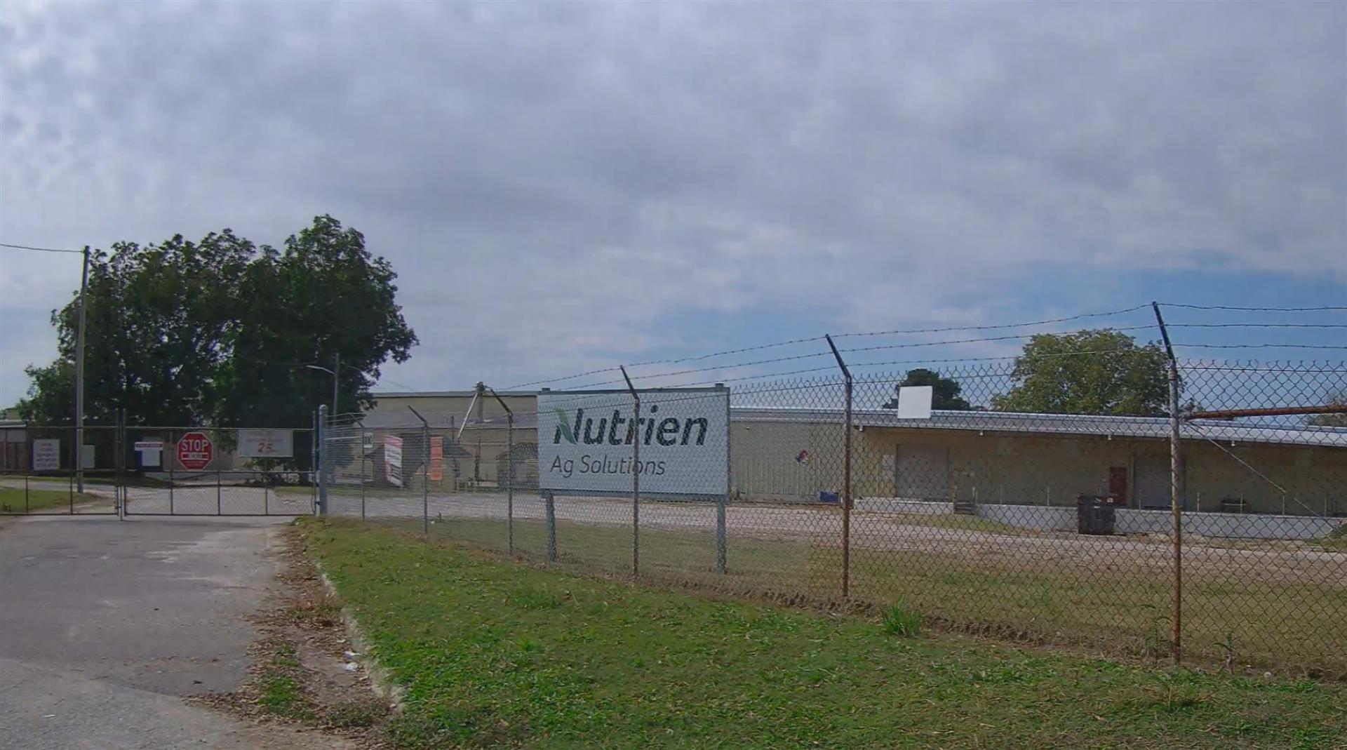
| Photo |
Photo 1
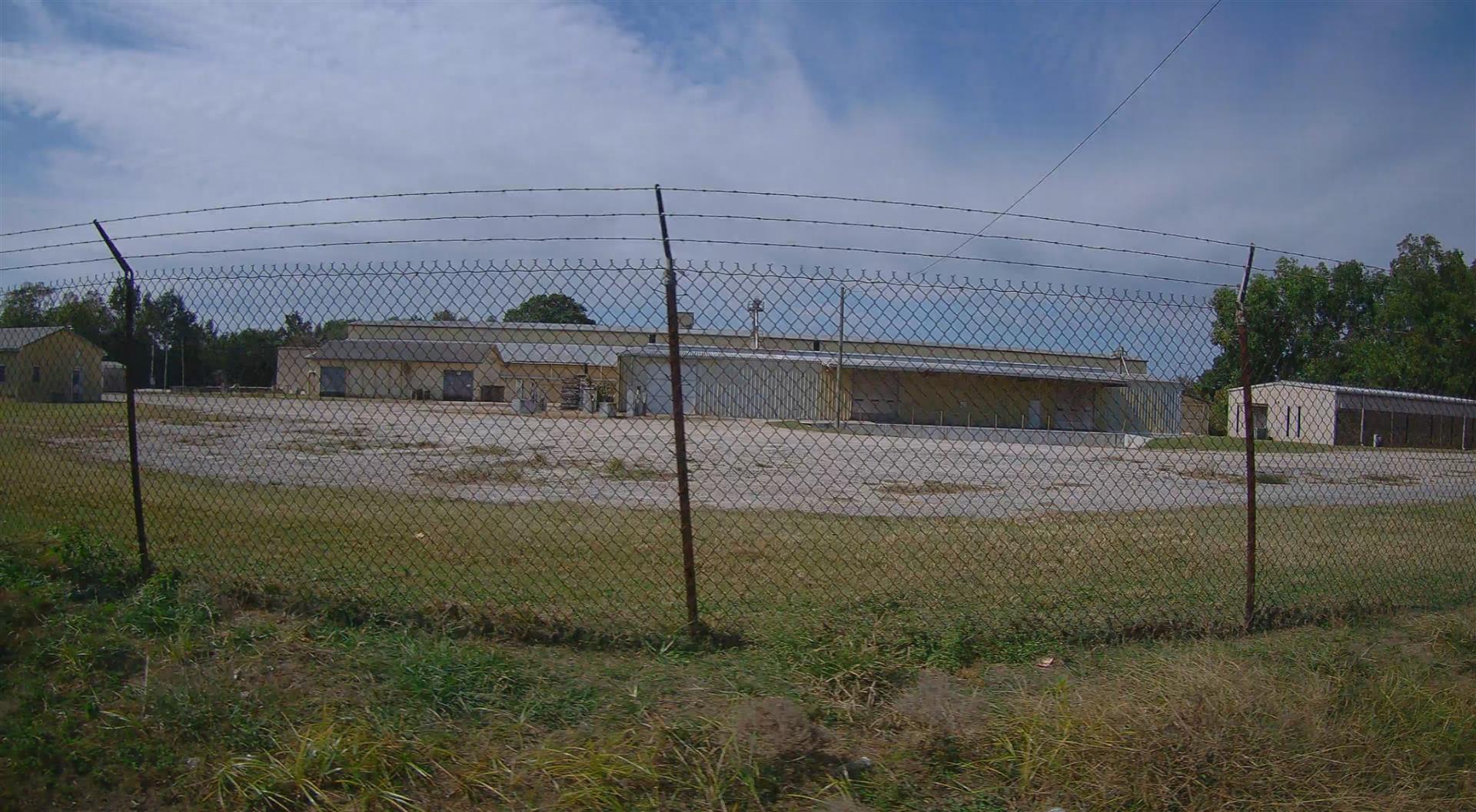 Photo 2
|
|
| Building
Sketch - NOTE: Sketches are updated the first day of every month. |
|
(Building 1) - Sketch for Parcel ID: 3721269295.000
NOTE: Sketches are updated the first day of every month.
 |
| Label |
Description |
Base SF |
Total SF |
| A |
OFFICE BUILDING |
2400.00 |
2400.00 |
| B |
CANOPY-ECONOMY |
36.00 |
.00 |
|
|
(Building 2) - Sketch for Parcel ID: 3721269295.000
NOTE: Sketches are updated the first day of every month.
 |
| Label |
Description |
Base SF |
Total SF |
| A |
WHSE |
12000.00 |
12000.00 |
| B |
UNCOV LOAD PLATFORM-ECNMY |
1992.00 |
.00 |
| C |
LOADING PLATFORM |
900.00 |
.00 |
|
|
(Building 3) - Sketch for Parcel ID: 3721269295.000
NOTE: Sketches are updated the first day of every month.
 |
| Label |
Description |
Base SF |
Total SF |
| A |
WHSE |
1740.00 |
1740.00 |
|
|
(Building 4) - Sketch for Parcel ID: 3721269295.000
NOTE: Sketches are updated the first day of every month.
 |
| Label |
Description |
Base SF |
Total SF |
|
|
(Building 5) - Sketch for Parcel ID: 3721269295.000
NOTE: Sketches are updated the first day of every month.
 |
| Label |
Description |
Base SF |
Total SF |
| A |
WHSE |
48468.00 |
48468.00 |
| B |
CANOPY W/ SLAB |
1216.00 |
.00 |
| C |
CANOPY W/ SLAB |
1440.00 |
.00 |
| D |
CANOPY-ROOF ONLY |
1620.00 |
.00 |
|
|
(Building 6) - Sketch for Parcel ID: 3721269295.000
NOTE: Sketches are updated the first day of every month.
 |
| Label |
Description |
Base SF |
Total SF |
| A |
OFFICE BUILDING |
480.00 |
480.00 |
| B |
PORCH-OPEN-FR |
160.00 |
.00 |
|
|
(Building 7) - Sketch for Parcel ID: 3721269295.000
NOTE: Sketches are updated the first day of every month.
 |
| Label |
Description |
Base SF |
Total SF |
| A |
WHSE |
14912.00 |
14912.00 |
| B |
LOADING PLATFORM |
1200.00 |
.00 |
| C |
OFFICE BUILDING |
288.00 |
288.00 |
| D |
LOADING PLATFORM |
1210.00 |
.00 |
|
|
|
|
|
| Map Acres |
9.63 |
| Tax District Note |
31 - C/CIWI-WILSON |
| Present-Use Info |
OFFICE |
| Zoning Code |
LI |
| Zoning Desc |
LIGHT INDUSTRIAL |
|
| Total Improvements Valuation
|
*Total Improvements Full Market Value $
|
**Total Improvements Assessed Value
|
572,928
|
572,928
|
*
Note - Market Value effective Date equal January 1, 2024, date of County’s most recent General
Reappraisal
** Note - If Assessed Value not equal Market Value then variance
resulting from formal appeal procedure |
|
| Land
Value Detail (Effective Date January 1, 2024, date
of County’s most recent General Reappraisal) |
Land
Full Value (LFV) $
|
Land
Present-Use Value (PUV) $ **
|
Land
Total Assessed Value $
|
163,597
|
163,597
|
163,597
|
| **
Note: If PUV equal LMV then parcel has
not qualified for present use program |
|
| Land
Detail (Effective Date January 1, 2024, date of County’s
most recent General Reappraisal) |
Rate Type |
Rate Code |
Description |
Quantity |
SF |
0601 |
FERTILIZER PLANTS |
419482.000 |
|
|
|
.000 |
|
|
|
|
