|
|
| 7965 A SIMPSON RD |
|
| LUCAMA , NC 27851-9371 |
|
| Property
Location Address |
|
| Parcel
ID No. |
2678642350.000 |
| PIN |
2678 64 2350 000 |
| Owner ID |
40433150 |
| |
|
| Tax
District |
20 - C/SW/BEULAH FD |
| |
| Land Use Code |
17 |
| Land Use Desc |
OFFICE |
| |
|
| Neighborhood |
8287 - SPRING_HILL |
|
| Legal
Desc |
7965 A SIMPSON RD |
| |
PARRISS LD 29.74AC |
| |
|
| Deed
Year Bk/Pg |
1981 - 1214 / 538 |
| Plat
Bk/Pg |
/ |
| |
Sales
Information |
| |
| Grantor |
|
| |
|
| Sold
Date |
0--0 |
| Sold
Amount $ |
0 |
|
| |
| Market Value $ |
5,329,331
|
| |
|
Market
Value - Land and all permanent improvements,
if any, effective January 1, 2024, date
of County’s most recent General Reappraisal
|
|
| |
|
| Assessed Value $ |
5,292,185
|
| |
If
Assessed Value not equal Market Value then
subject parcel designated as a special
class -agricultural, horticultural, or
forestland and thereby eligible for taxation
on basis of Present-Use.
|
|
|
| Year
Built |
2016 |
| Built
Use/Style |
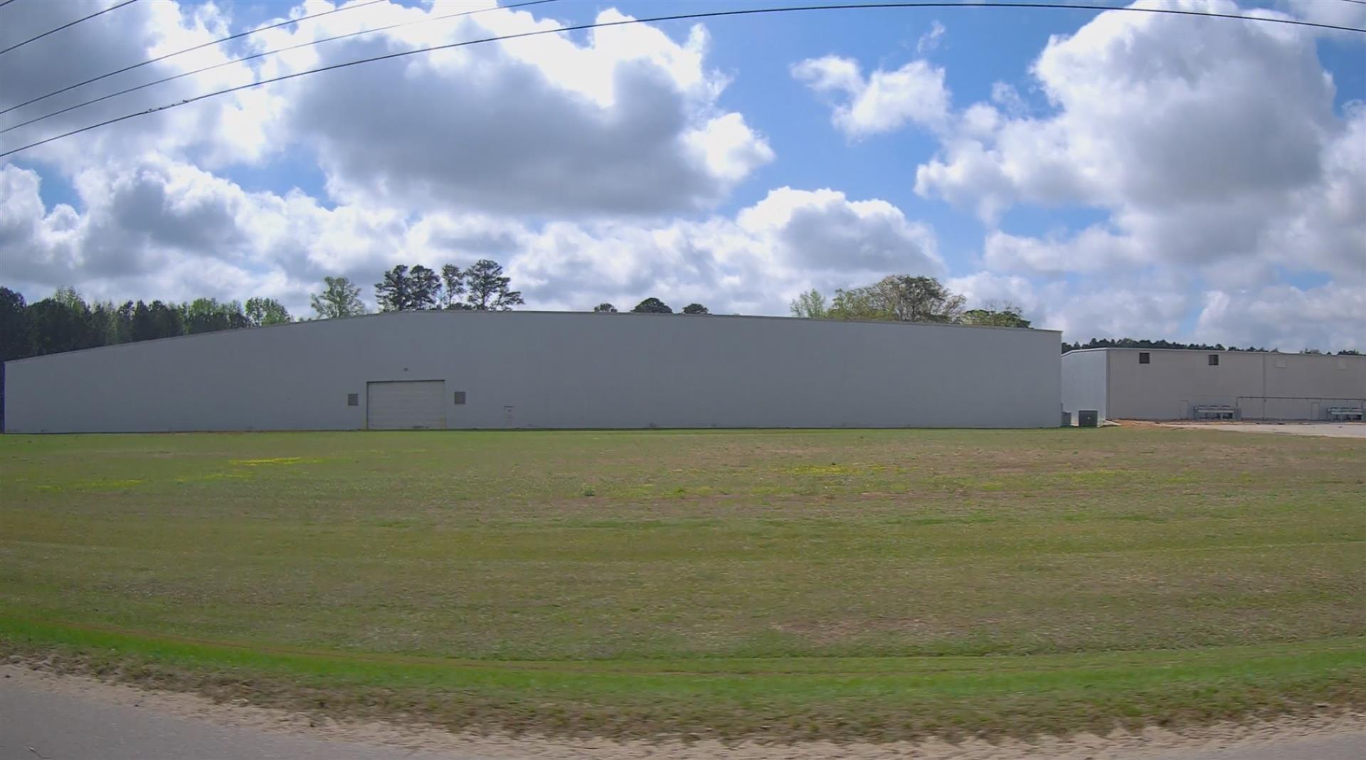
WAREHOUSE |
| Grade |
D+05 / D+05 GRADE |
| * Percent
Complete |
100 |
| Heated
Area (S/F) |
68,160 |
| Fireplace
(Y/N) |
N |
| Basement
(Y/N) |
N |
| ** Bedroom(s) |
0 |
| ** Bathroom(s) |
0 Full Bath(s) 0 Half Bath(s) |
| *** Multiple
Improvements |
007 |
*
Note - As of January 1
*
* Note - Bathroom(s), Bedroom(s), shown for description
only
* * * Note - If multiple improvements equal “MLT” then
parcel includes additional major improvements |
|
| Building
Sketch - NOTE: Sketches are updated the first day of every month. |
|
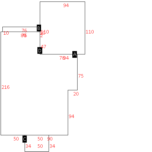
(Building 1) - Sketch for Parcel ID: 2678642350.000
NOTE: Sketches are updated the first day of every month.
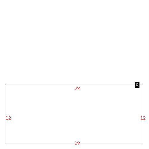 |
| Label |
Description |
Base SF |
Total SF |
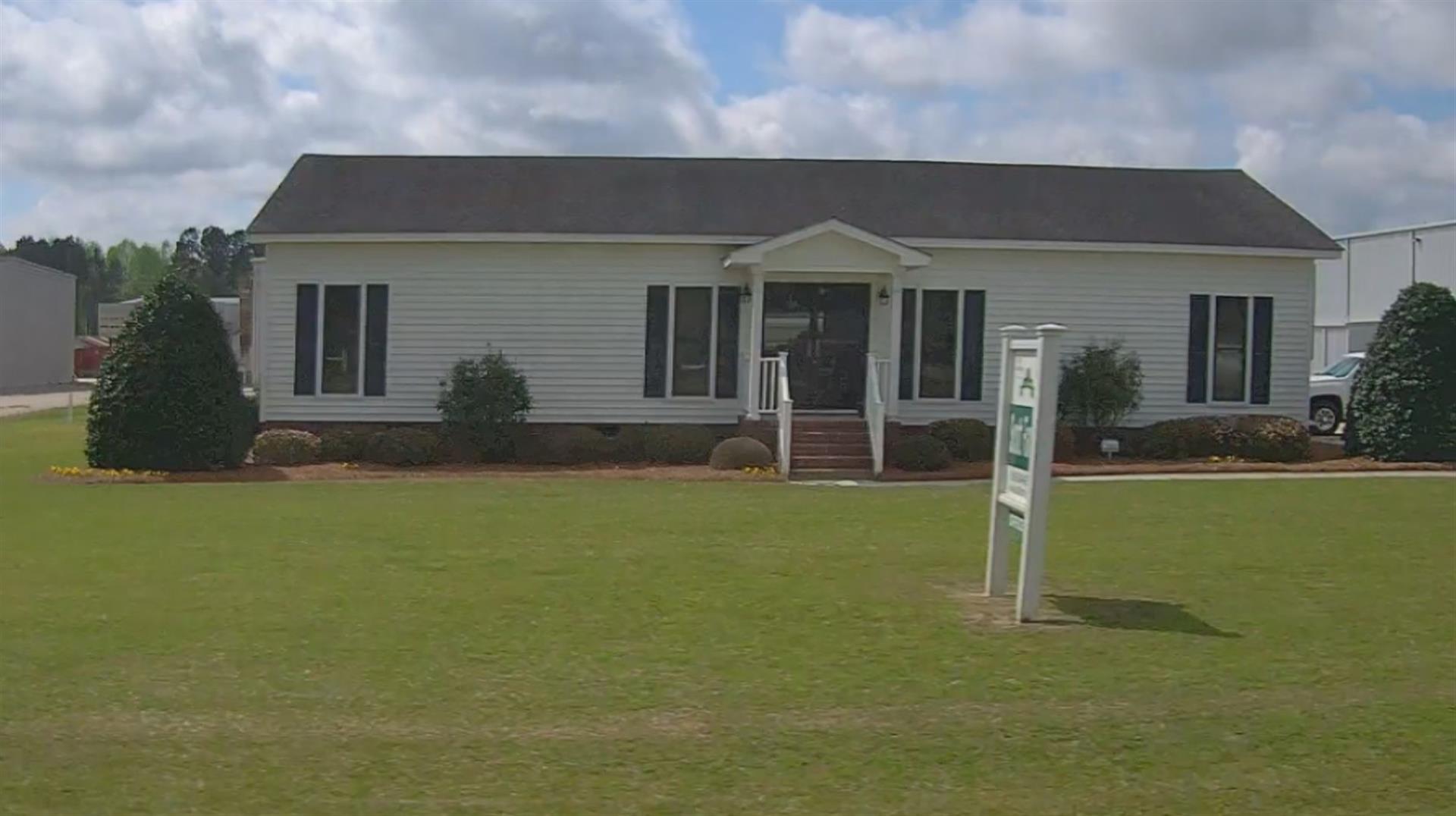
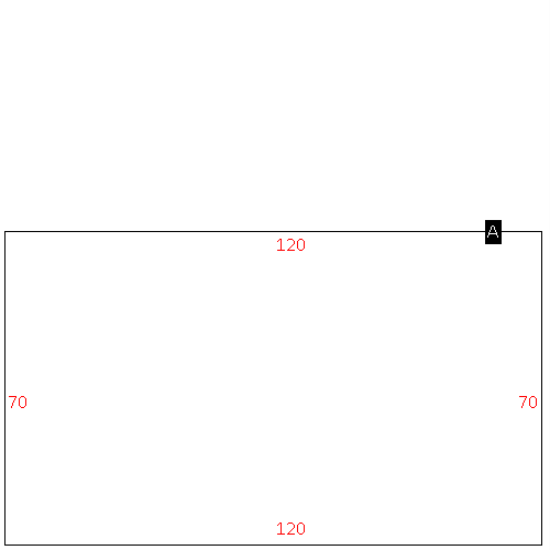
| A |
OFFICE BUILDING |
336.00 |
336.00 |
|
|
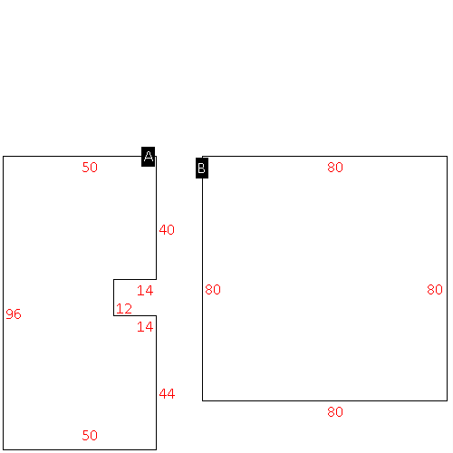
(Building 2) - Sketch for Parcel ID: 2678642350.000
NOTE: Sketches are updated the first day of every month.
 |
| Label |
Description |
Base SF |
Total SF |
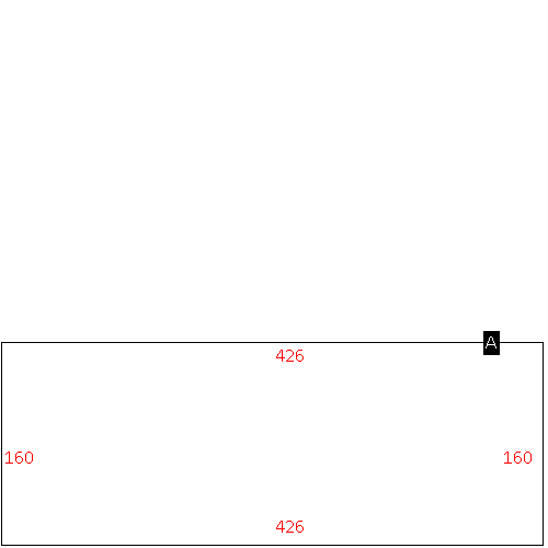
| A |
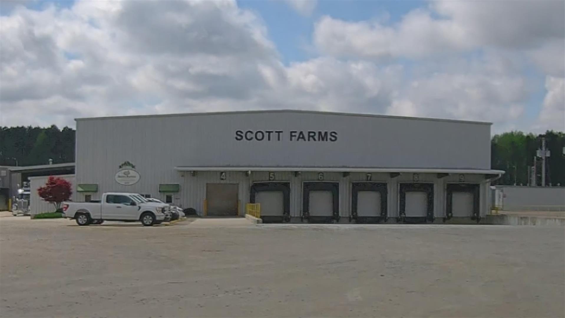
WHSE |
29014.00 |
29014.00 |
| B |
UTILITY STG-FR |
760.00 |
.00 |
| C |
OFFICE BUILDING |
1700.00 |
1700.00 |
| D |
CANOPY-ECONOMY |
10340.00 |
.00 |
|
|
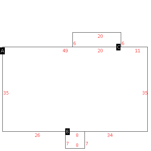
(Building 3) - Sketch for Parcel ID: 2678642350.000
NOTE: Sketches are updated the first day of every month.
 |
| Label |
Description |
Base SF |
Total SF |
| A |
WHSE |
4632.00 |
4632.00 |
| B |
WHSE |
6400.00 |
6400.00 |
|
|
(Building 4) - Sketch for Parcel ID: 2678642350.000
NOTE: Sketches are updated the first day of every month.
 |
| Label |
Description |
Base SF |
Total SF |
| A |
OFFICE BUILDING |
2100.00 |
2100.00 |
| B |
PORCH-OPEN-FR |
56.00 |
.00 |
| C |
PORCH-OPEN-FR |
120.00 |
.00 |
|
|
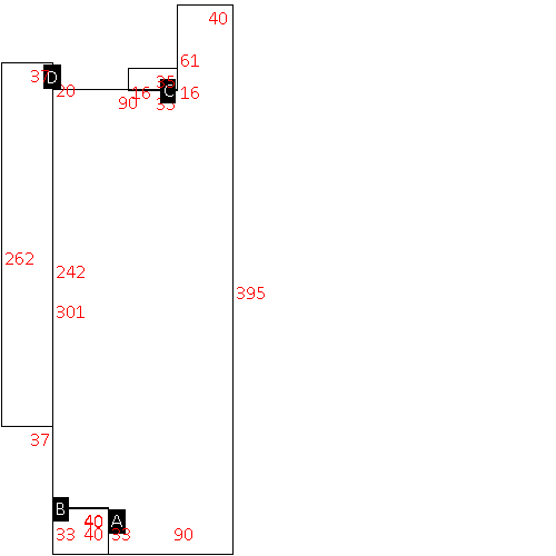
(Building 5) - Sketch for Parcel ID: 2678642350.000
NOTE: Sketches are updated the first day of every month.
 |
| Label |
Description |
Base SF |
Total SF |
| A |
WHSE |
44540.00 |
44540.00 |
| B |
WHSE-OFFICE |
1320.00 |
1320.00 |
| C |
UTILITY STG-FR |
560.00 |
.00 |
| D |
CANOPY-COMMERCIAL |
9694.00 |
.00 |
|
|
(Building 6) - Sketch for Parcel ID: 2678642350.000
NOTE: Sketches are updated the first day of every month.
 |
| Label |
Description |
Base SF |
Total SF |
| A |
WHSE |
8400.00 |
8400.00 |
|
|
(Building 7) - Sketch for Parcel ID: 2678642350.000
NOTE: Sketches are updated the first day of every month.
 |
| Label |
Description |
Base SF |
Total SF |
| A |
WHSE |
68160.00 |
68160.00 |
|
|
|
|
|
| Map Acres |
29.74 |
| Tax District Note |
20 - C/SW/BEULAH FD |
| Present-Use Info |
OFFICE |
| Zoning Code |
AR |
| Zoning Desc |
AGRICUL-RESID 40M SF |
|
| Total Improvements Valuation
|
*Total Improvements Full Market Value $
|
**Total Improvements Assessed Value
|
5,184,629
|
5,184,629
|
*
Note - Market Value effective Date equal January 1, 2024, date of County’s most recent General
Reappraisal
** Note - If Assessed Value not equal Market Value then variance
resulting from formal appeal procedure |
|
| Land
Value Detail (Effective Date January 1, 2024, date
of County’s most recent General Reappraisal) |
Land
Full Value (LFV) $
|
Land
Present-Use Value (PUV) $ **
|
Land
Total Assessed Value $
|
144,702
|
107,556
|
107,556
|
| **
Note: If PUV equal LMV then parcel has
not qualified for present use program |
|
| Land
Detail (Effective Date January 1, 2024, date of County’s
most recent General Reappraisal) |
Rate Type |
Rate Code |
Description |
Quantity |
AC |
0600 |
INDUSTRIAL |
3.000 |
|
|
|
.000 |
AC |
5211 |
MKT OPEN LD PVD CLASS 2 |
14.480 |
LU |
5210 |
|
14.480 |
AC |
6111 |
MKT WOODS PVD CLASS 1 |
12.260 |
LU |
6110 |
|
12.260 |
|
|
|
|