|
|
| 304 E JONES ST |
|
| RALEIGH , NC 27601 |
|
| Property
Location Address |
|
| Parcel
ID No. |
3617289089.000 |
| PIN |
3617 28 9089 000 |
| Owner ID |
1127964 |
| |
|
| Tax
District |
16 - C/SW/LEE WOODARD FD |
| |
| Land Use Code |
50 |
| Land Use Desc |
RURAL HOMESITE |
| |
|
| Neighborhood |
8031 - BLACK_CREEK_TWP |
|
| Legal
Desc |
6371 MORNINGSIDE RD |
| |
TR-2&3 153.97AC |
| |
|
| Deed
Year Bk/Pg |
2022 - 2977 / 46 |
| Plat
Bk/Pg |
2 / 53 |
| |
Sales
Information |
| |
| Grantor |
DANIEL CAROLYN BRASWELL |
| |
|
| Sold
Date |
2022-08-08 |
| Sold
Amount $ |
1,500,000 |
|
| |
| Market Value $ |
1,128,049
|
| |
|
Market
Value - Land and all permanent improvements,
if any, effective January 1, 2024, date
of County’s most recent General Reappraisal
|
|
| |
|
| Assessed Value $ |
1,008,085
|
| |
If
Assessed Value not equal Market Value then
subject parcel designated as a special
class -agricultural, horticultural, or
forestland and thereby eligible for taxation
on basis of Present-Use.
|
|
|
| Year
Built |
1987 |
| Built
Use/Style |
SFR-UPTO 2.0 STY W/ADDN |
| Grade |
A / A GRADE |
| * Percent
Complete |
100 |
| Heated
Area (S/F) |
4,353 |
| Fireplace
(Y/N) |
Y |
| Basement
(Y/N) |
N |
| ** Bedroom(s) |
2 |
| ** Bathroom(s) |
3 Full Bath(s) 0 Half Bath(s) |
| *** Multiple
Improvements |
002 |
*
Note - As of January 1
*
* Note - Bathroom(s), Bedroom(s), shown for description
only
* * * Note - If multiple improvements equal “MLT” then
parcel includes additional major improvements |
|
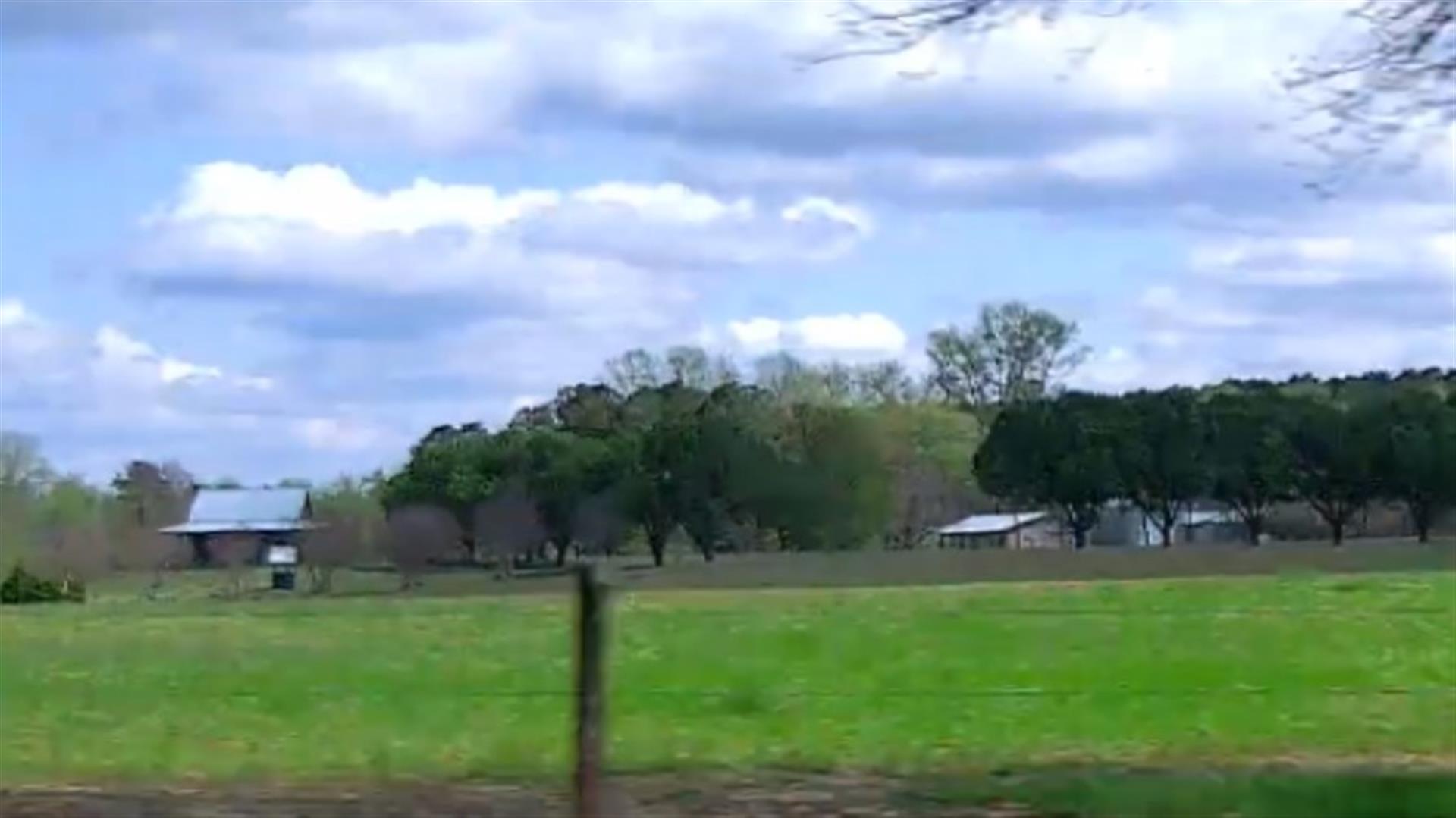
| Photo |
Photo 1
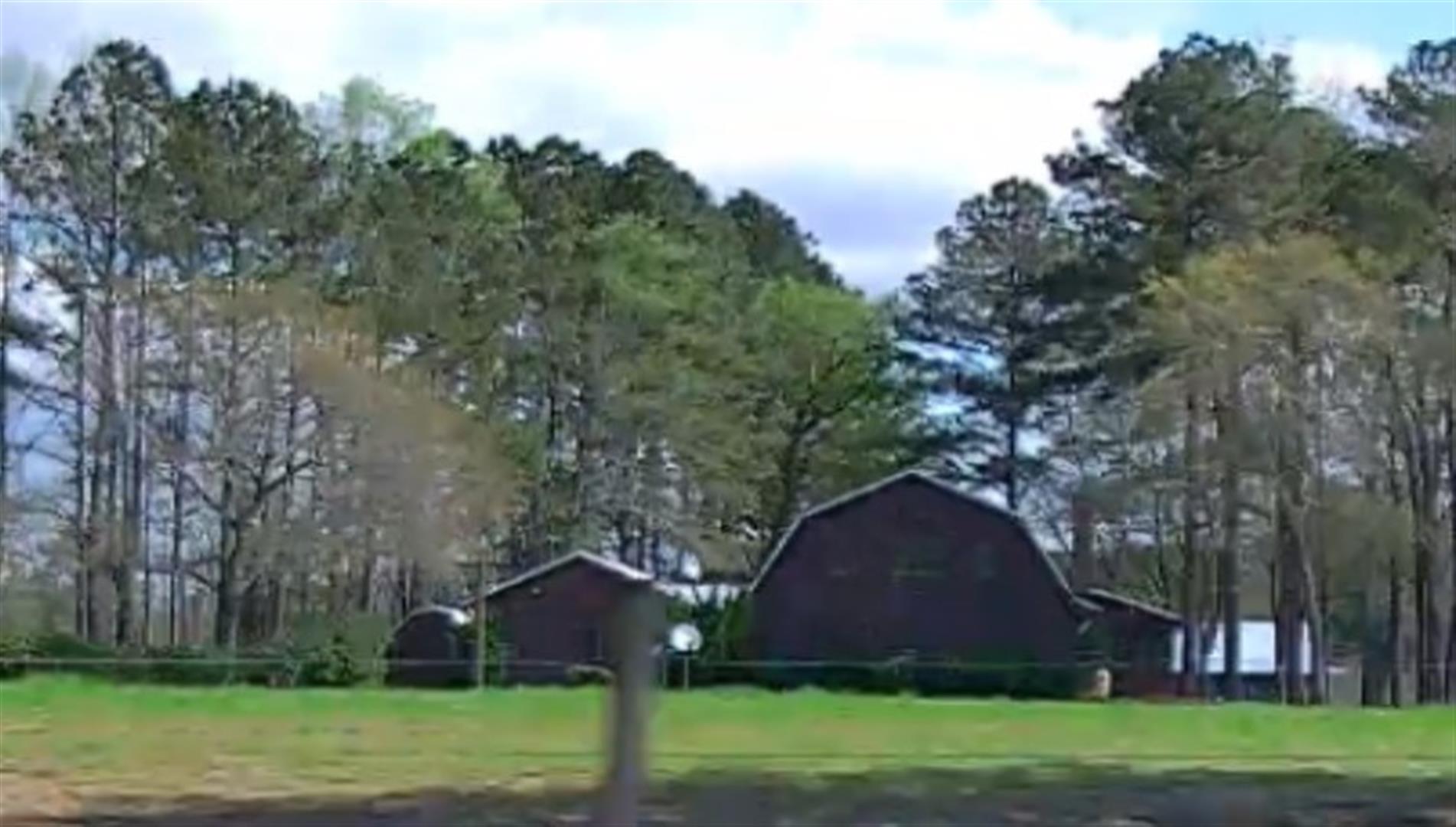 Photo 2
|
|
| Building
Sketch - NOTE: Sketches are updated the first day of every month. |
|
(Building 1) - Sketch for Parcel ID: 3617289089.000
NOTE: Sketches are updated the first day of every month.
 |
| Label |
Description |
Base SF |
Total SF |
| A |
SFR-1.5 STY |
480.00 |
480.00 |
| B |
PORCH-OPEN-FR |
840.00 |
.00 |
|
|
(Building 2) - Sketch for Parcel ID: 3617289089.000
NOTE: Sketches are updated the first day of every month.
 |
| Label |
Description |
Base SF |
Total SF |
| A |
SFR-2.0 STY |
1800.00 |
2952.00 |
| B |
DECK-WOOD |
624.00 |
.00 |
| C |
PORCH-SCR-MAS |
240.00 |
.00 |
| D |
SFR-ADDT FR |
1149.00 |
1149.00 |
|
|
|
|
|
| Map Acres |
153.97 |
| Tax District Note |
16 - C/SW/LEE WOODARD FD |
| Present-Use Info |
RURAL HOMESITE |
| Zoning Code |
AR |
| Zoning Desc |
AGRICUL-RESID 40M SF |
|
| Total Improvements Valuation
|
*Total Improvements Full Market Value $
|
**Total Improvements Assessed Value
|
900,527
|
900,527
|
*
Note - Market Value effective Date equal January 1, 2024, date of County’s most recent General
Reappraisal
** Note - If Assessed Value not equal Market Value then variance
resulting from formal appeal procedure |
|
| Land
Value Detail (Effective Date January 1, 2024, date
of County’s most recent General Reappraisal) |
Land
Full Value (LFV) $
|
Land
Present-Use Value (PUV) $ **
|
Land
Total Assessed Value $
|
227,522
|
107,558
|
107,558
|
| **
Note: If PUV equal LMV then parcel has
not qualified for present use program |
|
| Land
Detail (Effective Date January 1, 2024, date of County’s
most recent General Reappraisal) |
Rate Type |
Rate Code |
Description |
Quantity |
AC |
5010 |
RURAL HOMESITE PAVED |
2.000 |
|
|
|
.000 |
AC |
5111 |
MKT OPEN LD PVD CLASS 1 |
13.800 |
LU |
5110 |
|
13.800 |
AC |
5211 |
MKT OPEN LD PVD CLASS 2 |
24.200 |
LU |
5210 |
|
24.200 |
AC |
6111 |
MKT WOODS PVD CLASS 1 |
10.000 |
LU |
6110 |
|
10.000 |
AC |
6211 |
MKT WOODS PVD CLASS 2 |
23.300 |
LU |
6210 |
|
23.300 |
AC |
6311 |
MKT WOODS PVD CLASS 3 |
80.670 |
LU |
6310 |
|
80.670 |
|
|
|
|
