|
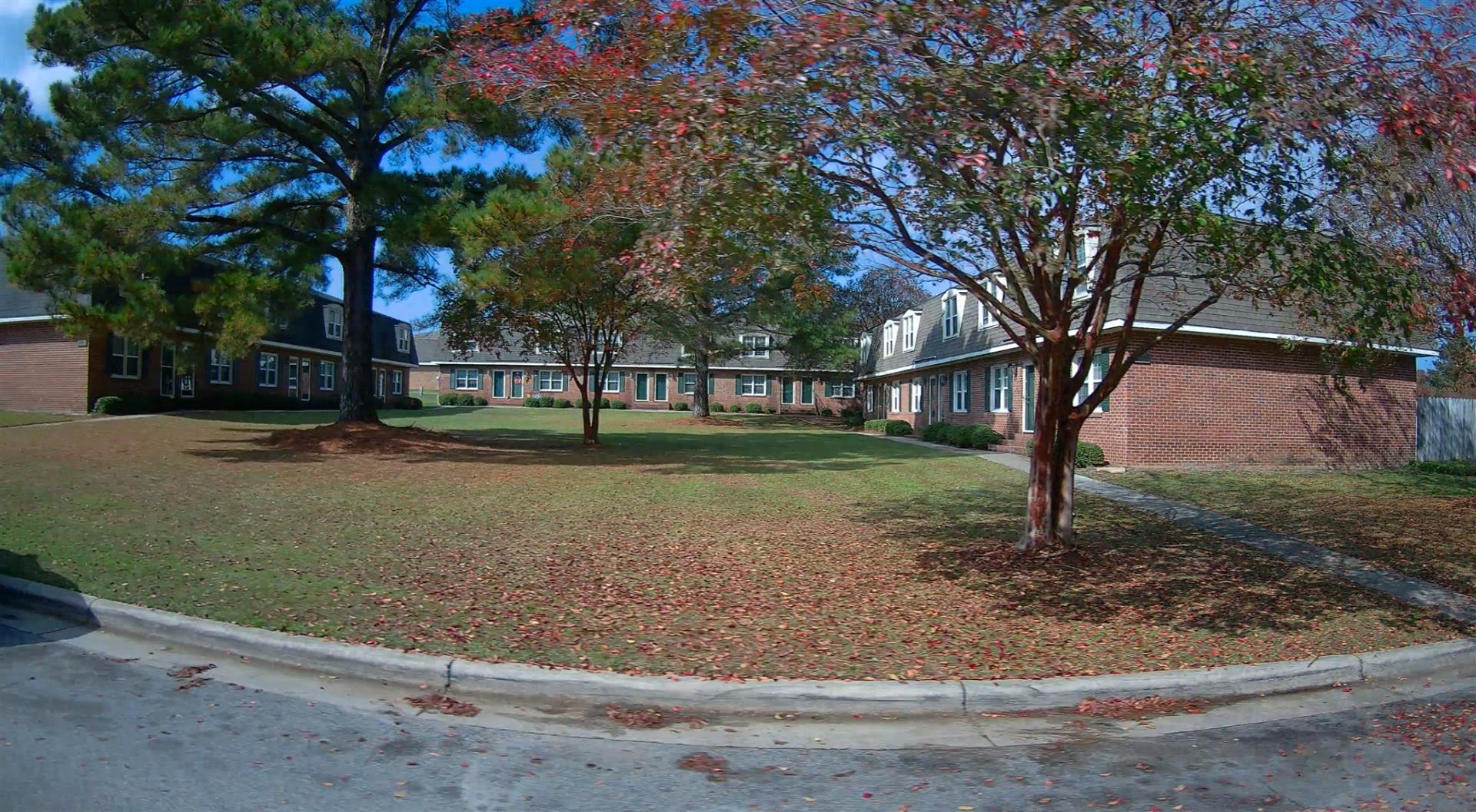
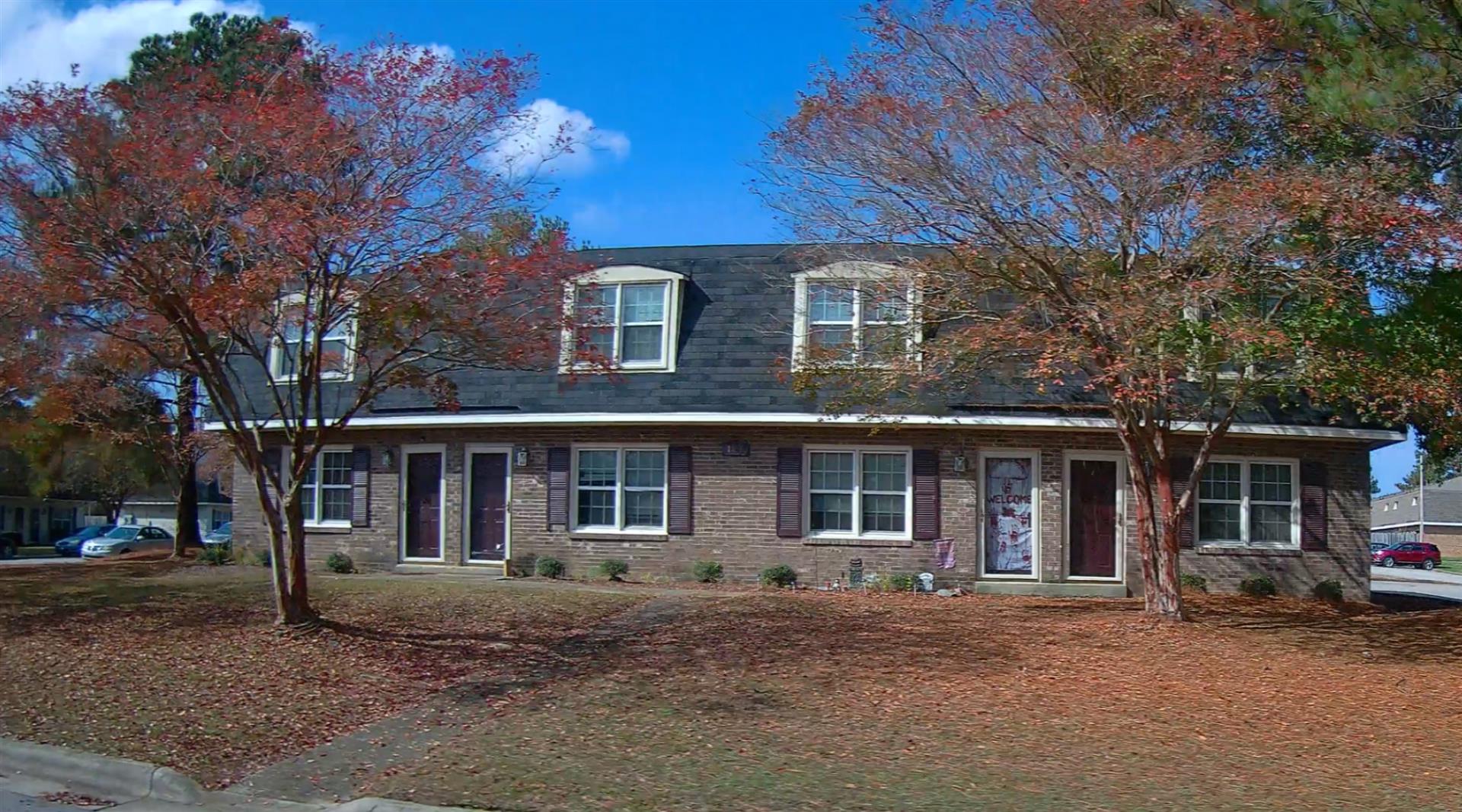
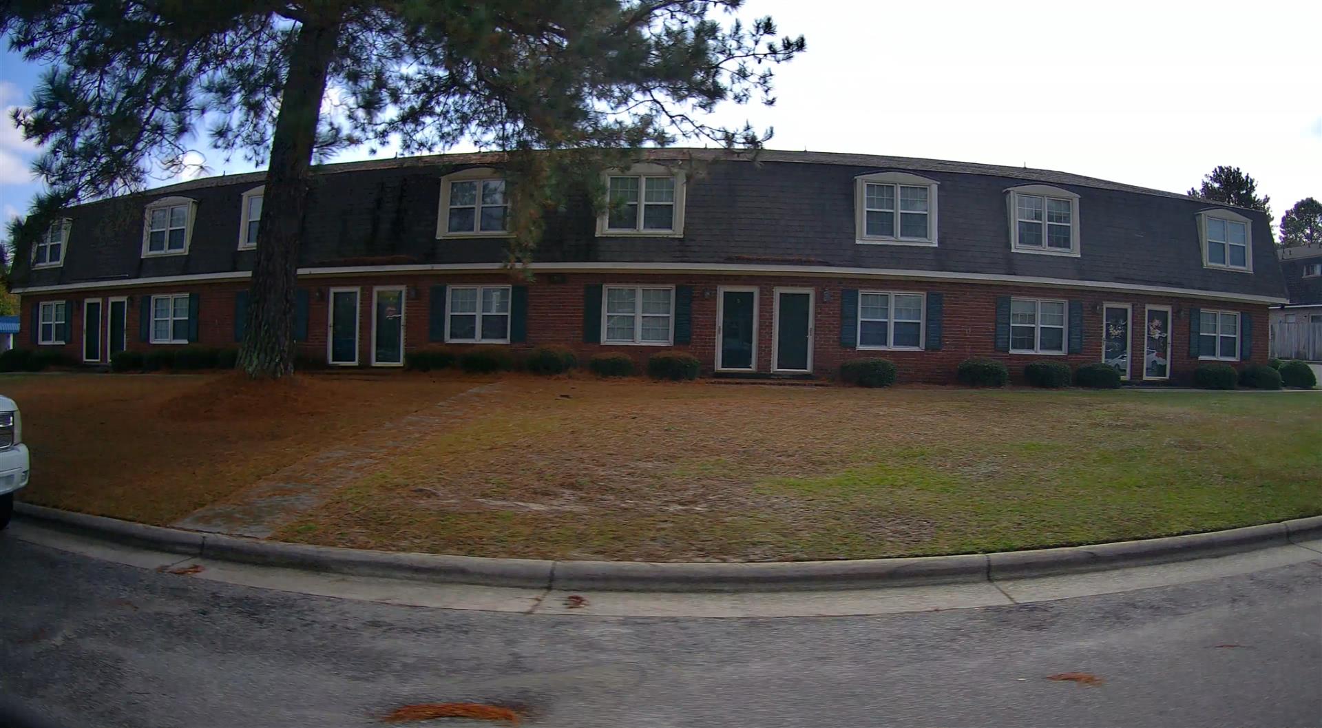
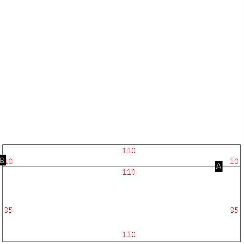
(Building 1) - Sketch for Parcel ID: 3722297608.000
NOTE: Sketches are updated the first day of every month.
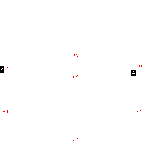 |
| Label |
Description |
Base SF |
Total SF |
| A |
APT-TOWNHOUSE |
2312.00 |
4624.00 |
| B |
PATIO-CONC |
680.00 |
.00 |
|
|
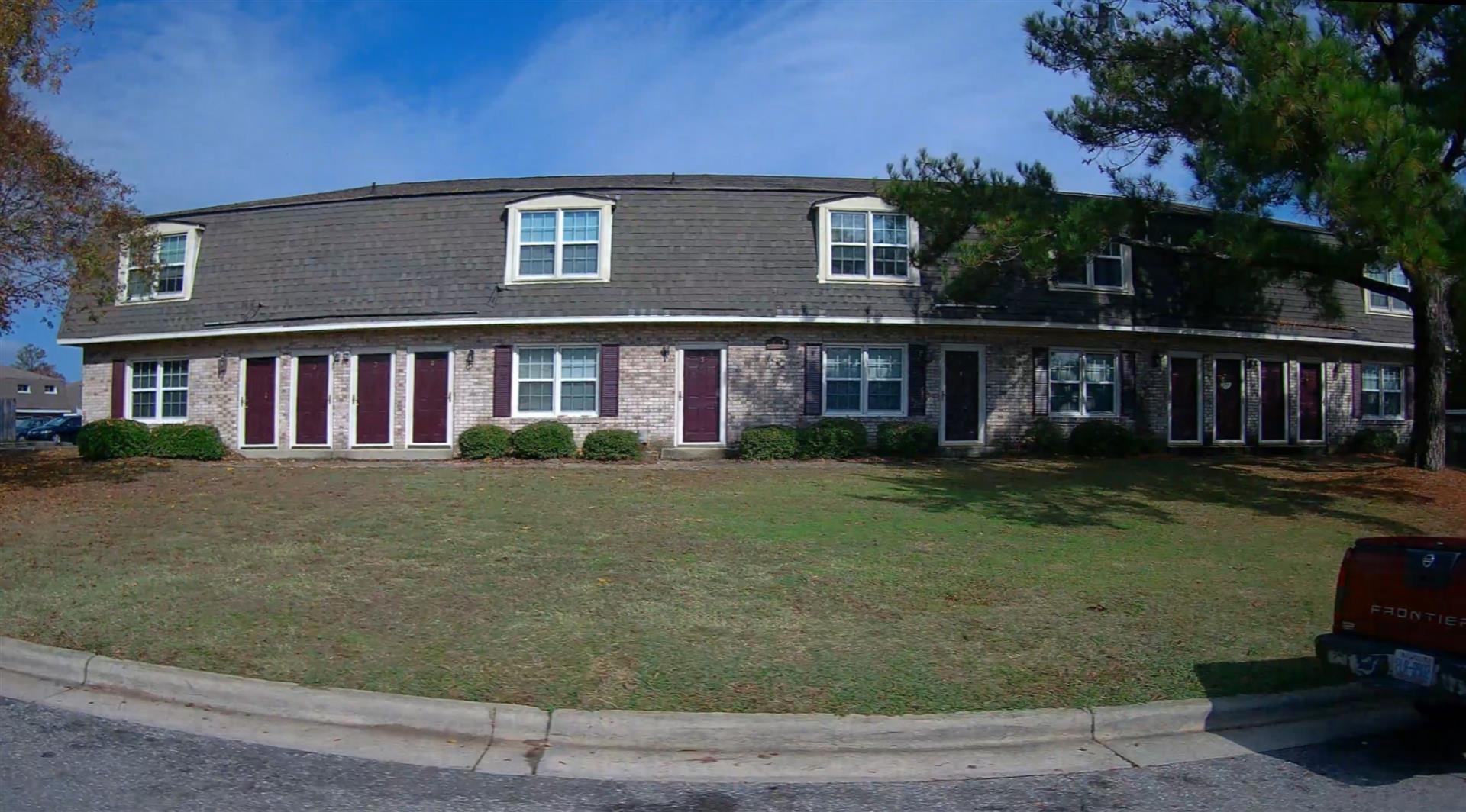
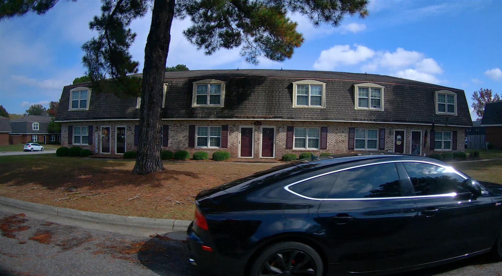
(Building 2) - Sketch for Parcel ID: 3722297608.000
NOTE: Sketches are updated the first day of every month.
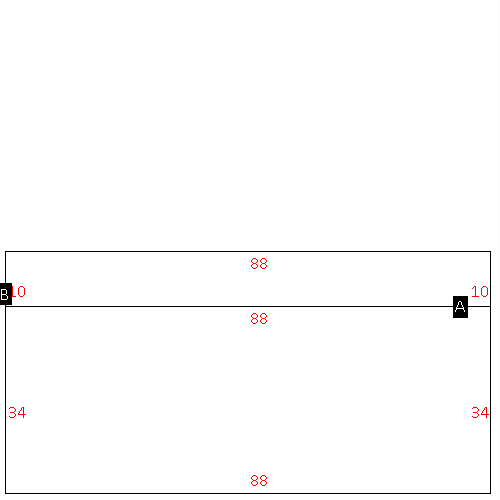 |
| Label |
Description |
Base SF |
Total SF |
| A |
APT-GARDEN |
2992.00 |
5984.00 |
| B |
PATIO-CONC |
880.00 |
.00 |
|
|
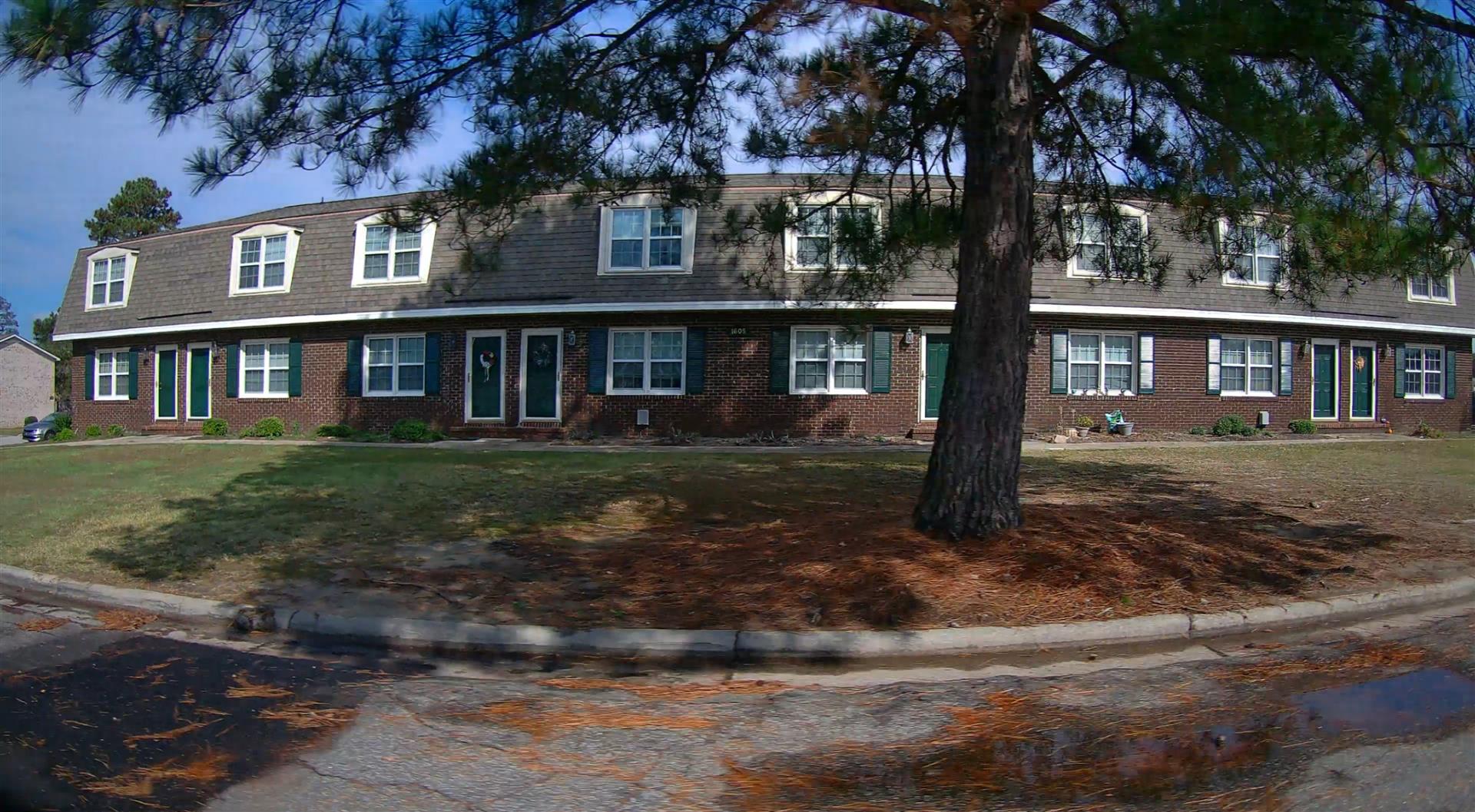
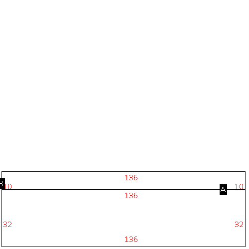
(Building 3) - Sketch for Parcel ID: 3722297608.000
NOTE: Sketches are updated the first day of every month.
 |
| Label |
Description |
Base SF |
Total SF |
| A |
APT-TOWNHOUSE |
4352.00 |
8704.00 |
| B |
PATIO-CONC |
1360.00 |
.00 |
|
|
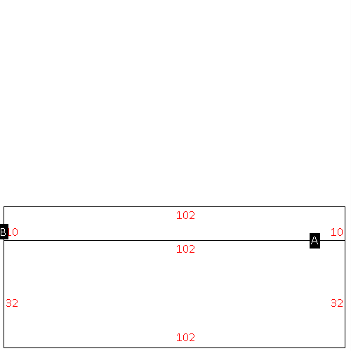
(Building 4) - Sketch for Parcel ID: 3722297608.000
NOTE: Sketches are updated the first day of every month.
 |
| Label |
Description |
Base SF |
Total SF |
| A |
APT-TOWNHOUSE |
3264.00 |
6528.00 |
| B |
PATIO-CONC |
1020.00 |
.00 |
|
|
(Building 5) - Sketch for Parcel ID: 3722297608.000
NOTE: Sketches are updated the first day of every month.
 |
| Label |
Description |
Base SF |
Total SF |
| A |
APT-GARDEN |
3850.00 |
7700.00 |
| B |
PATIO-CONC |
1100.00 |
.00 |
|
|
(Building 6) - Sketch for Parcel ID: 3722297608.000
NOTE: Sketches are updated the first day of every month.
 |
| Label |
Description |
Base SF |
Total SF |
| A |
APT-TOWNHOUSE |
3080.00 |
6160.00 |
| B |
PATIO-CONC |
880.00 |
.00 |
|
|
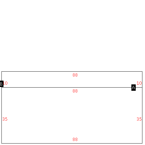
(Building 7) - Sketch for Parcel ID: 3722297608.000
NOTE: Sketches are updated the first day of every month.
 |
| Label |
Description |
Base SF |
Total SF |
| A |
APT-GARDEN |
3080.00 |
6160.00 |
| B |
PATIO-CONC |
880.00 |
.00 |
|
|
(Building 8) - Sketch for Parcel ID: 3722297608.000
NOTE: Sketches are updated the first day of every month.
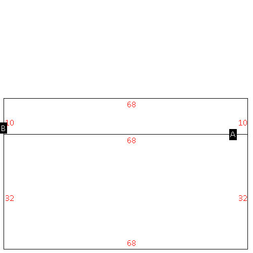 |
| Label |
Description |
Base SF |
Total SF |
| A |
APT-TOWNHOUSE |
2176.00 |
4352.00 |
| B |
PATIO-CONC |
680.00 |
.00 |
|
|
(Building 9) - Sketch for Parcel ID: 3722297608.000
NOTE: Sketches are updated the first day of every month.
 |
| Label |
Description |
Base SF |
Total SF |
| A |
APT-TOWNHOUSE |
4352.00 |
8704.00 |
| B |
PATIO-CONC |
1360.00 |
.00 |
|
|
(Building 10) - Sketch for Parcel ID: 3722297608.000
NOTE: Sketches are updated the first day of every month.
 |
| Label |
Description |
Base SF |
Total SF |
| A |
APT-TOWNHOUSE |
4352.00 |
8704.00 |
| B |
PATIO-CONC |
1360.00 |
.00 |
|
|
(Building 11) - Sketch for Parcel ID: 3722297608.000
NOTE: Sketches are updated the first day of every month.
 |
| Label |
Description |
Base SF |
Total SF |
| A |
APT-TOWNHOUSE |
3264.00 |
6528.00 |
| B |
PATIO-CONC |
1020.00 |
.00 |
|
|
(Building 12) - Sketch for Parcel ID: 3722297608.000
NOTE: Sketches are updated the first day of every month.
 |
| Label |
Description |
Base SF |
Total SF |
| A |
APT-TOWNHOUSE |
4352.00 |
8704.00 |
| B |
PATIO-CONC |
1360.00 |
.00 |
|
|
(Building 13) - Sketch for Parcel ID: 3722297608.000
NOTE: Sketches are updated the first day of every month.
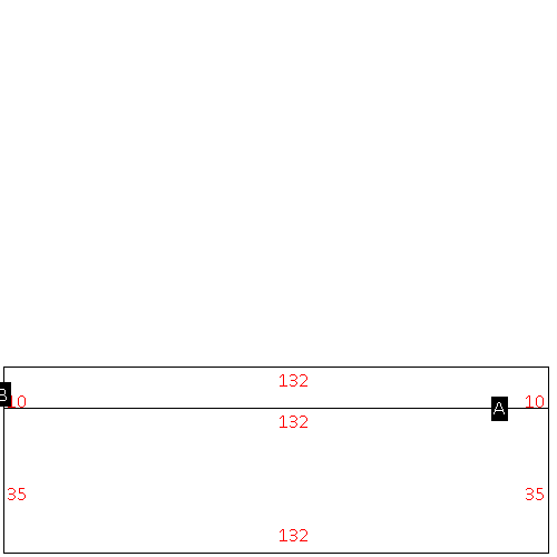 |
| Label |
Description |
Base SF |
Total SF |
| A |
APT-GARDEN |
4620.00 |
9240.00 |
| B |
PATIO-CONC |
1320.00 |
.00 |
|
|
(Building 14) - Sketch for Parcel ID: 3722297608.000
NOTE: Sketches are updated the first day of every month.
 |
| Label |
Description |
Base SF |
Total SF |
| A |
APT-TOWNHOUSE |
4352.00 |
8704.00 |
| B |
PATIO-CONC |
1360.00 |
.00 |
|
|
(Building 15) - Sketch for Parcel ID: 3722297608.000
NOTE: Sketches are updated the first day of every month.
 |
| Label |
Description |
Base SF |
Total SF |
| A |
APT-TOWNHOUSE |
3264.00 |
6528.00 |
| B |
PATIO-CONC |
1020.00 |
.00 |
|
|
(Building 16) - Sketch for Parcel ID: 3722297608.000
NOTE: Sketches are updated the first day of every month.
 |
| Label |
Description |
Base SF |
Total SF |
| A |
APT-TOWNHOUSE |
3264.00 |
6528.00 |
| B |
PATIO-CONC |
1020.00 |
.00 |
|
|
(Building 17) - Sketch for Parcel ID: 3722297608.000
NOTE: Sketches are updated the first day of every month.
 |
| Label |
Description |
Base SF |
Total SF |
| A |
APT-TOWNHOUSE |
4352.00 |
8704.00 |
| B |
PATIO-CONC |
1360.00 |
.00 |
|
|
(Building 18) - Sketch for Parcel ID: 3722297608.000
NOTE: Sketches are updated the first day of every month.
 |
| Label |
Description |
Base SF |
Total SF |
| A |
APT-TOWNHOUSE |
3264.00 |
6528.00 |
| B |
PATIO-CONC |
1020.00 |
.00 |
|
|
(Building 19) - Sketch for Parcel ID: 3722297608.000
NOTE: Sketches are updated the first day of every month.
 |
| Label |
Description |
Base SF |
Total SF |
| A |
APT-TOWNHOUSE |
3080.00 |
6160.00 |
| B |
PATIO-CONC |
880.00 |
.00 |
|
|
(Building 20) - Sketch for Parcel ID: 3722297608.000
NOTE: Sketches are updated the first day of every month.
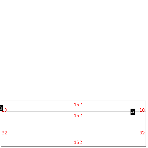 |
| Label |
Description |
Base SF |
Total SF |
| A |
APT-TOWNHOUSE |
4224.00 |
8448.00 |
| B |
PATIO-CONC |
1320.00 |
.00 |
|
|
(Building 21) - Sketch for Parcel ID: 3722297608.000
NOTE: Sketches are updated the first day of every month.
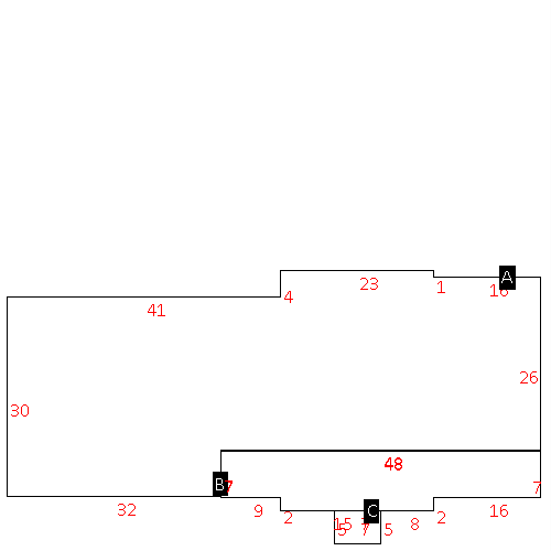 |
| Label |
Description |
Base SF |
Total SF |
| A |
OFFICE BUILDING |
2204.00 |
2204.00 |
| B |
PORCH-OPEN-FR |
382.00 |
.00 |
| C |
STOOP-MAS |
35.00 |
.00 |
|
|
|